Angel Eye View LLC provides construction drone services in Loveland, CO and Northern Colorado. Document progress with repeatable aerial views, aerial mapping and 3D models, and high-resolution imagery. Available across Colorado by arrangement.
No handoffs, no outsourced editing. Chris Steingrube plans the flight, captures the data, and processes it on encrypted local workstations, so your imagery and site data never touch a public server.
LAANC airspace authorizationVisual observers on complex sitesEncrypted local processingPrivacy-first publication
3D reconstruction · point-cloud derivedALL-SAINTS / CO
Selected work
Construction progress, documented.
Revisit agreed viewpoints to build a dated visual record of site conditions, earthwork, and building activity. Plan capture frequency around your project reporting needs.
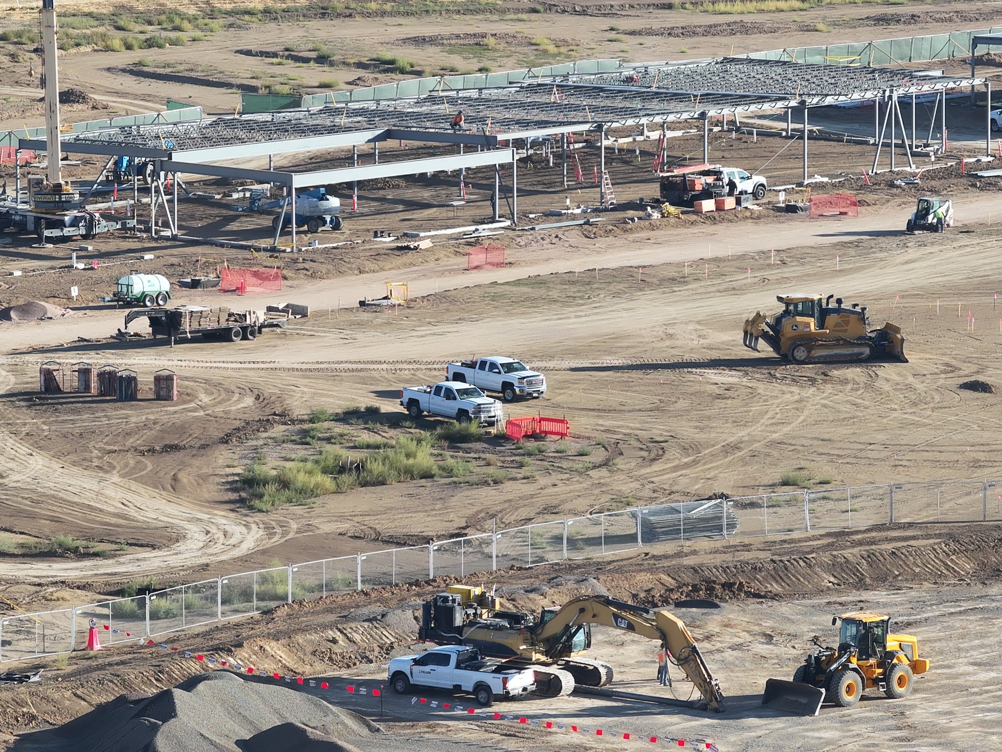
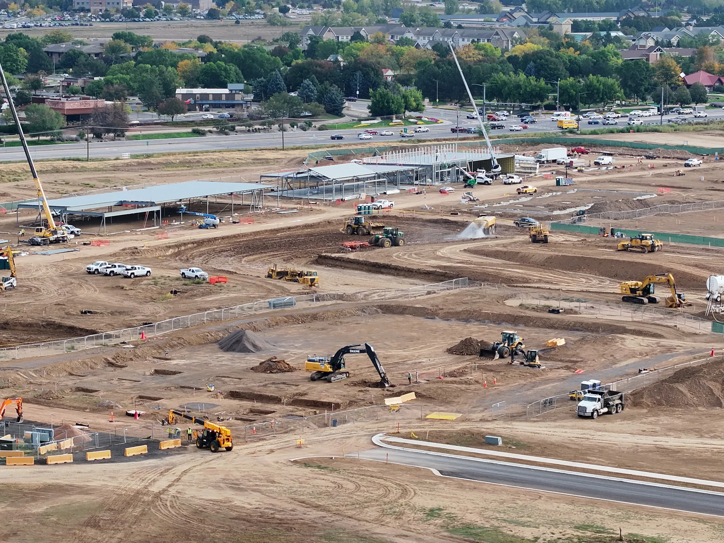
Commercial steel construction · September 28, 2026INDEPENDENT DEMONSTRATION
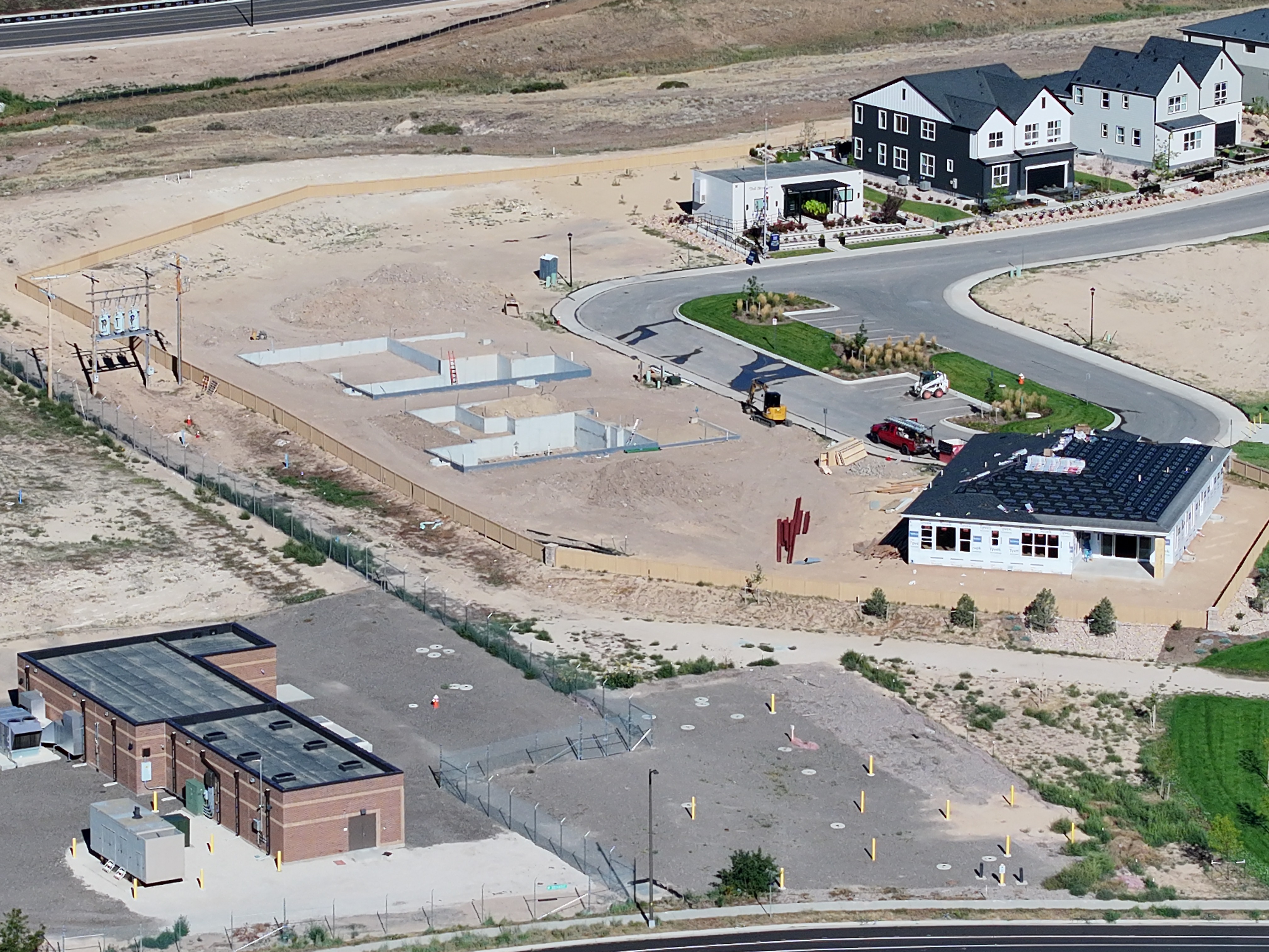
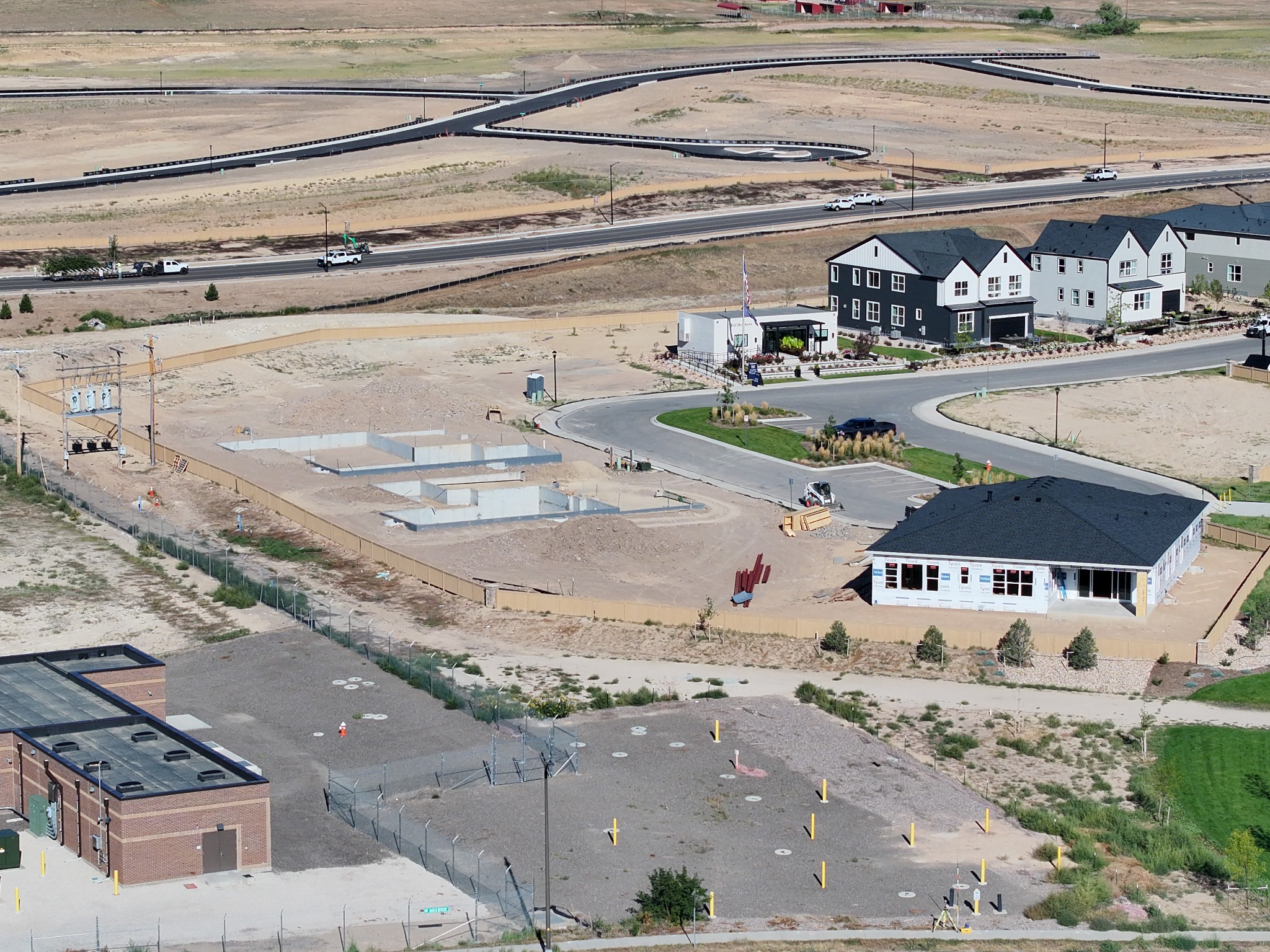
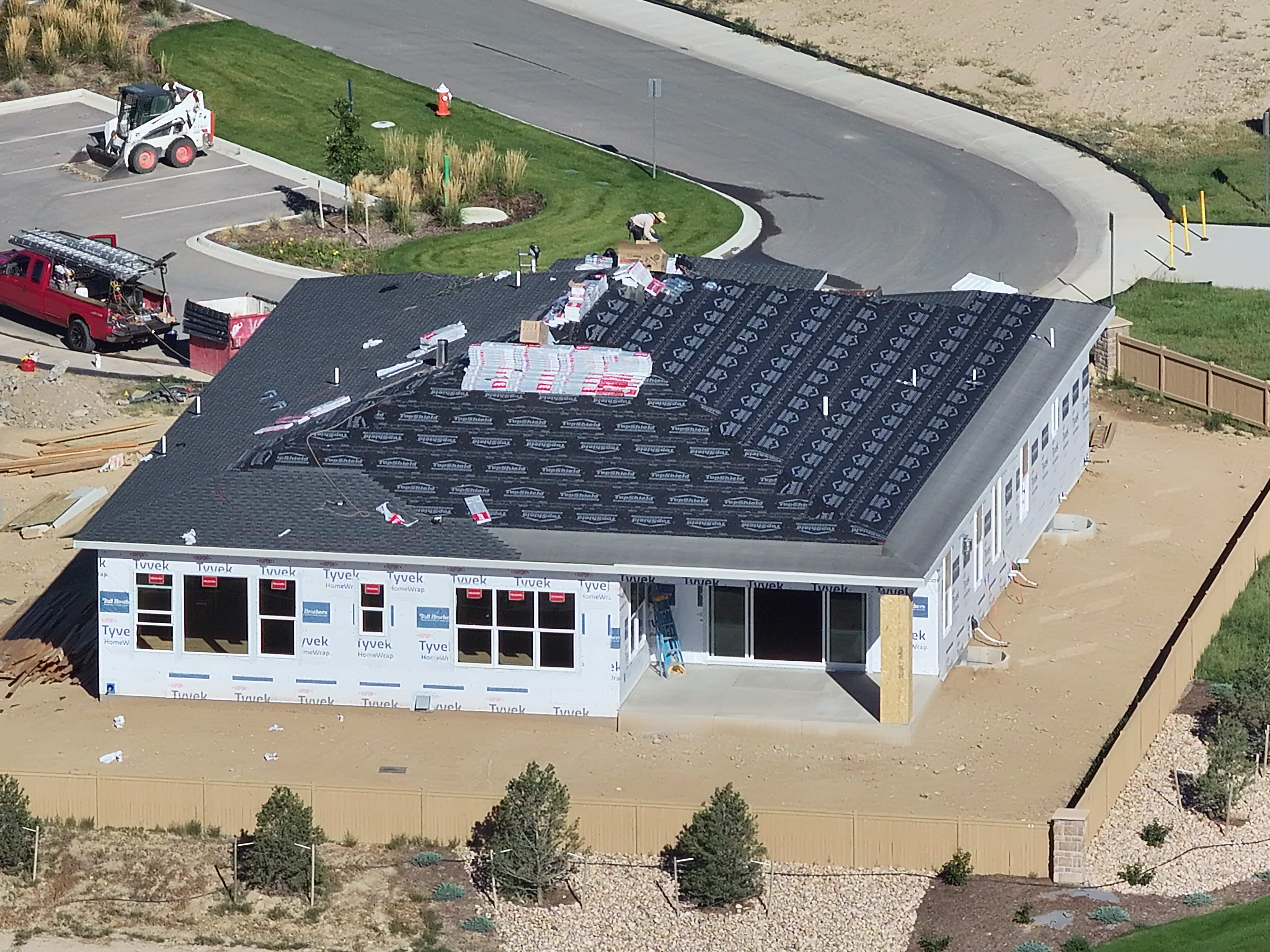
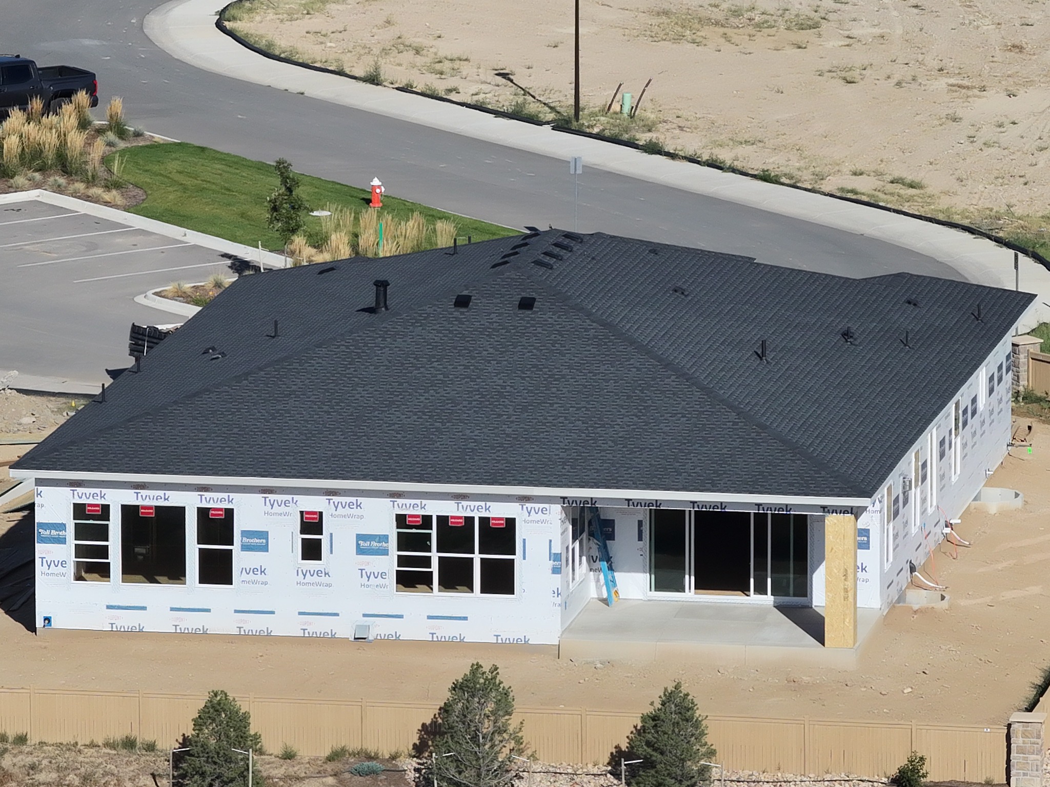
Residential construction · September 28, 2026INDEPENDENT DEMONSTRATION
Based in Loveland, Colorado
Drone services for Northern Colorado projects.
From recurring construction visits to a planned mapping flight, choose the capture around the decisions your team needs to make. Angel Eye View serves Loveland and Northern Colorado, with other Colorado projects available by arrangement.
Construction progress documentation
Dated aerial photographs connect the overall jobsite with specific work areas. Agree on viewpoints and visit frequency to build a visual record for project updates.
Orthomosaics combine overlapping images into a top-down site view. Point clouds and textured 3D models help teams explore site context; aerial data collection can also support your own processing workflow.
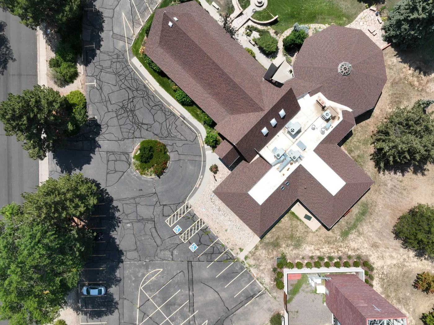
Close-up drone imagery documents visible roof, facade, and signage conditions. Aerial photos and video also record completed construction and renovation work.
To scope a project, share its location, the areas you need documented, the intended use of the images or data, and your preferred visit schedule. Flight feasibility, deliverables, and turnaround are confirmed with the quote.
Construction progress documentation. Loveland & Northern Colorado.
Aerial site documentation for contractors who need a clear view of current conditions and a consistent record as work moves forward.
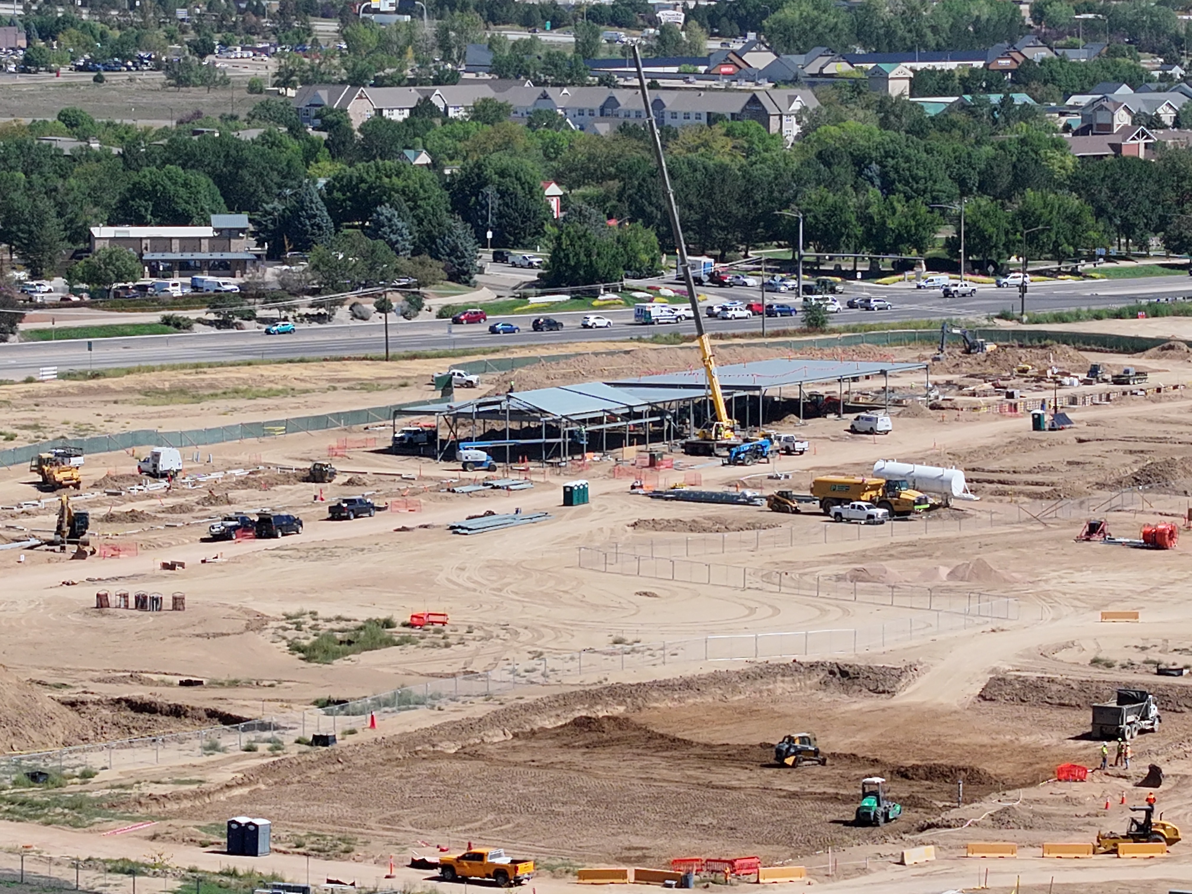
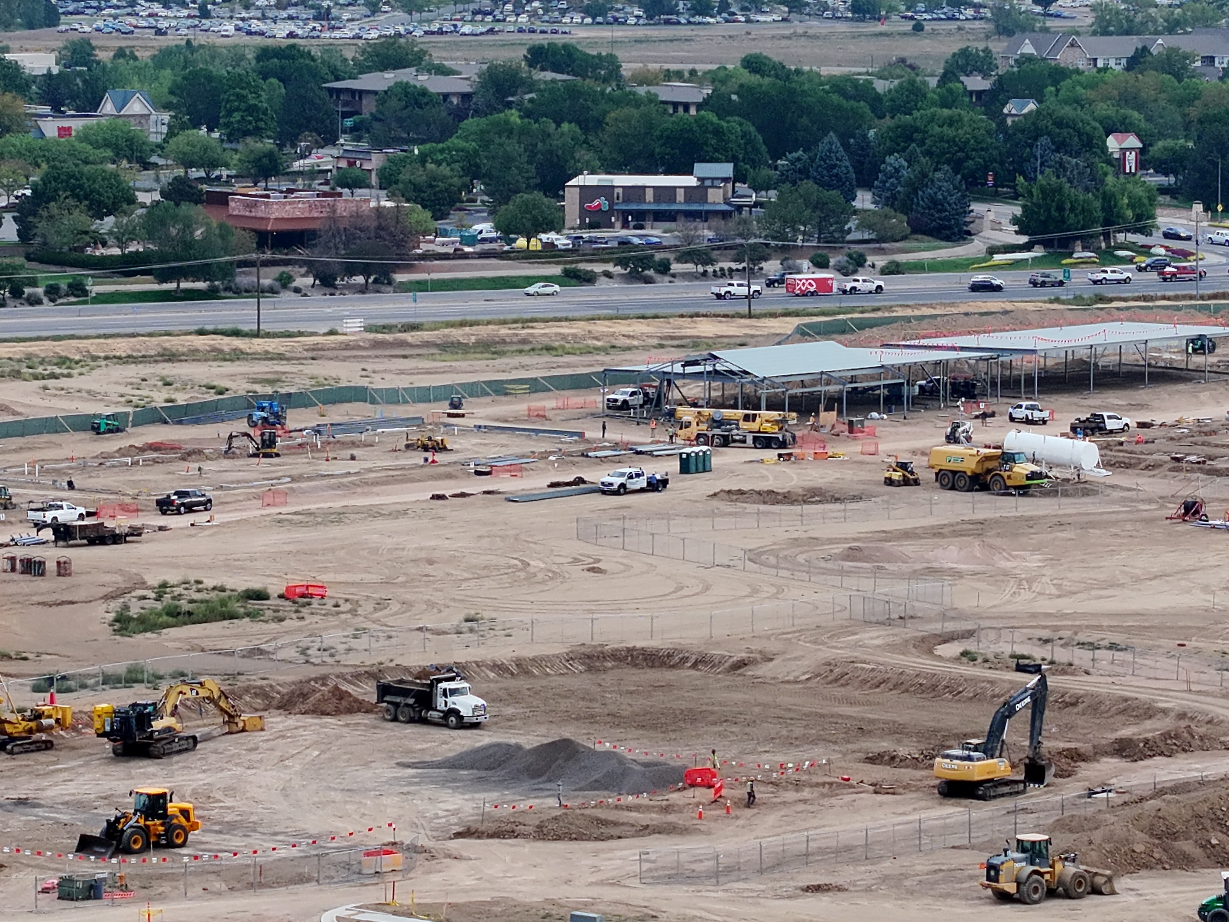
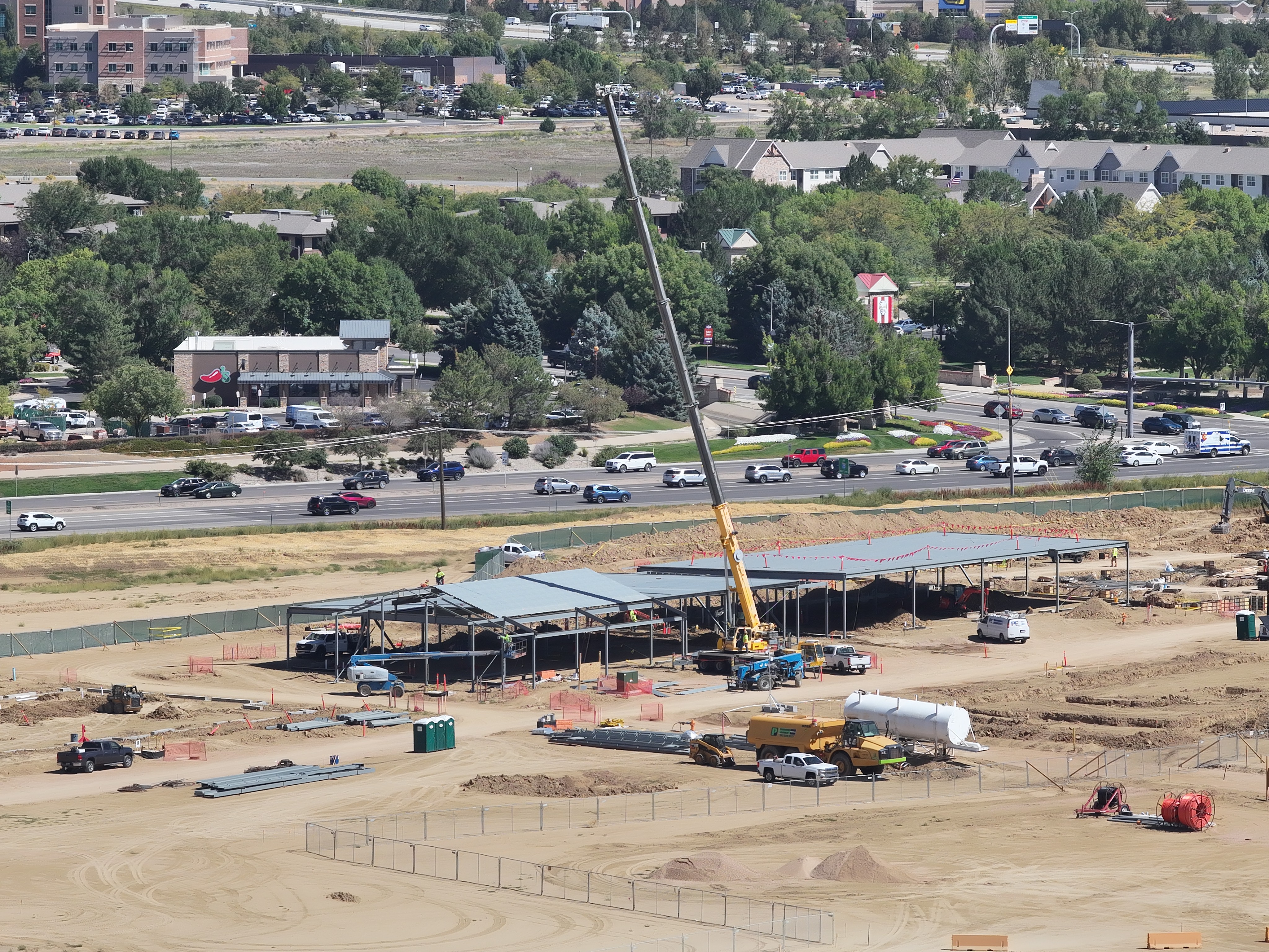
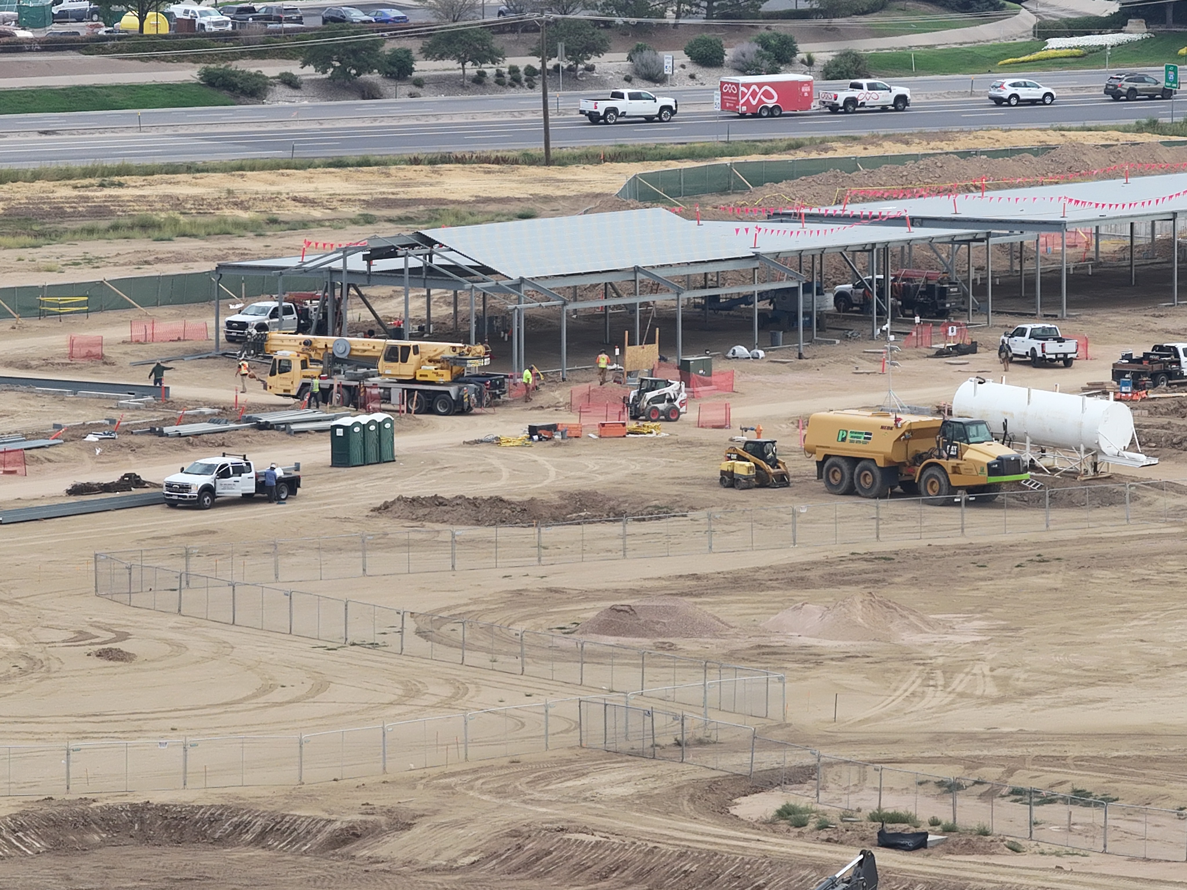
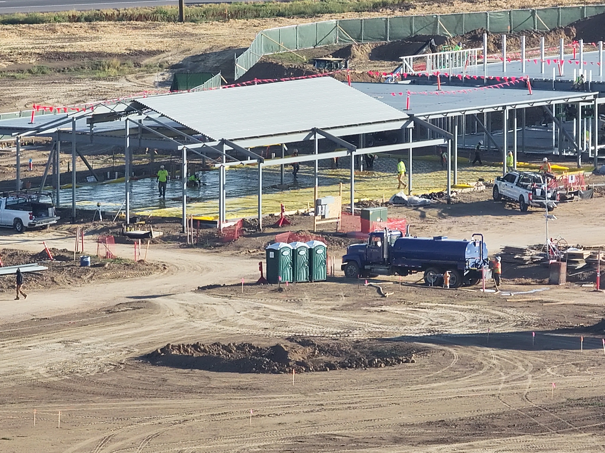
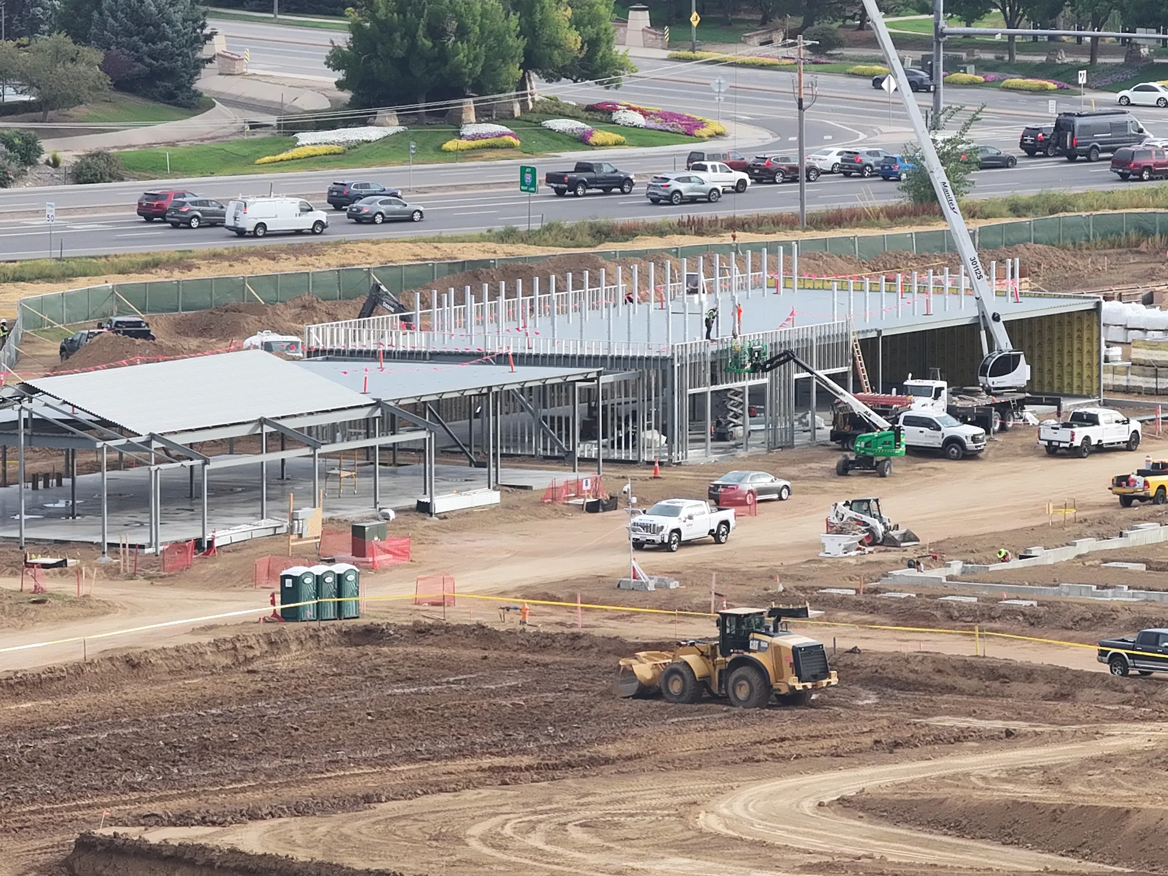
Construction Progress Documentation — Recurring aerial visits connect overall site context with specific work areas. Dated overviews and detail photographs give contractors a visual record to compare across visits and share in project updates.
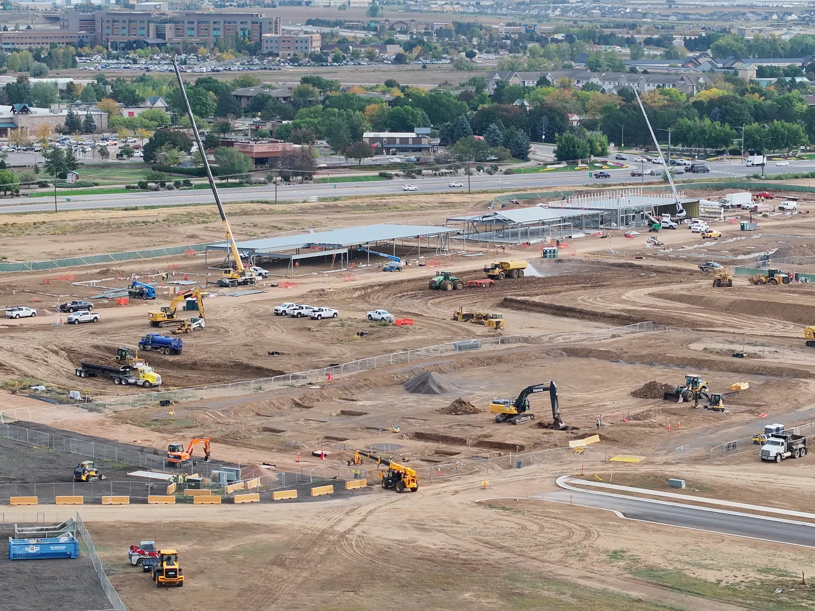
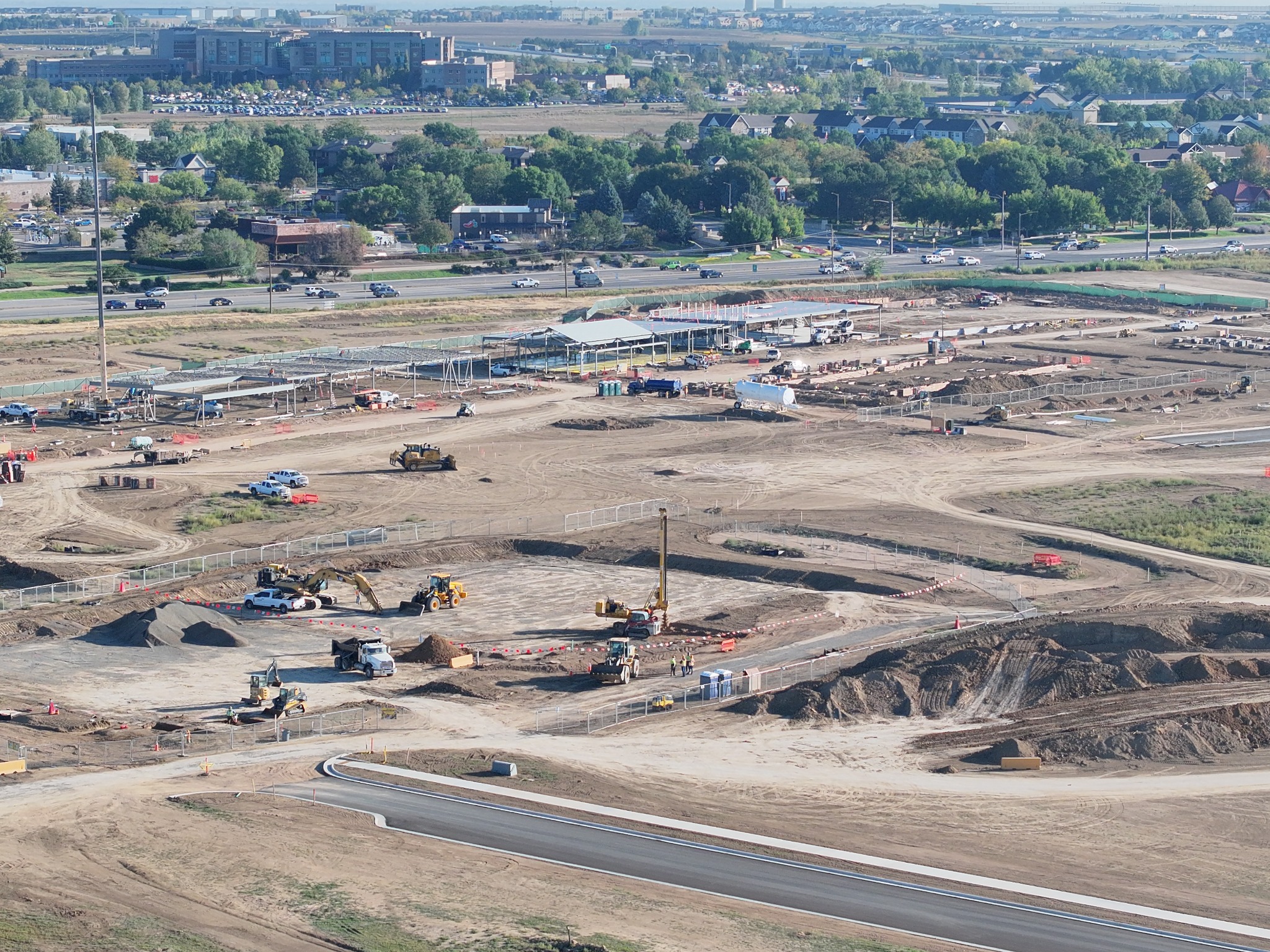
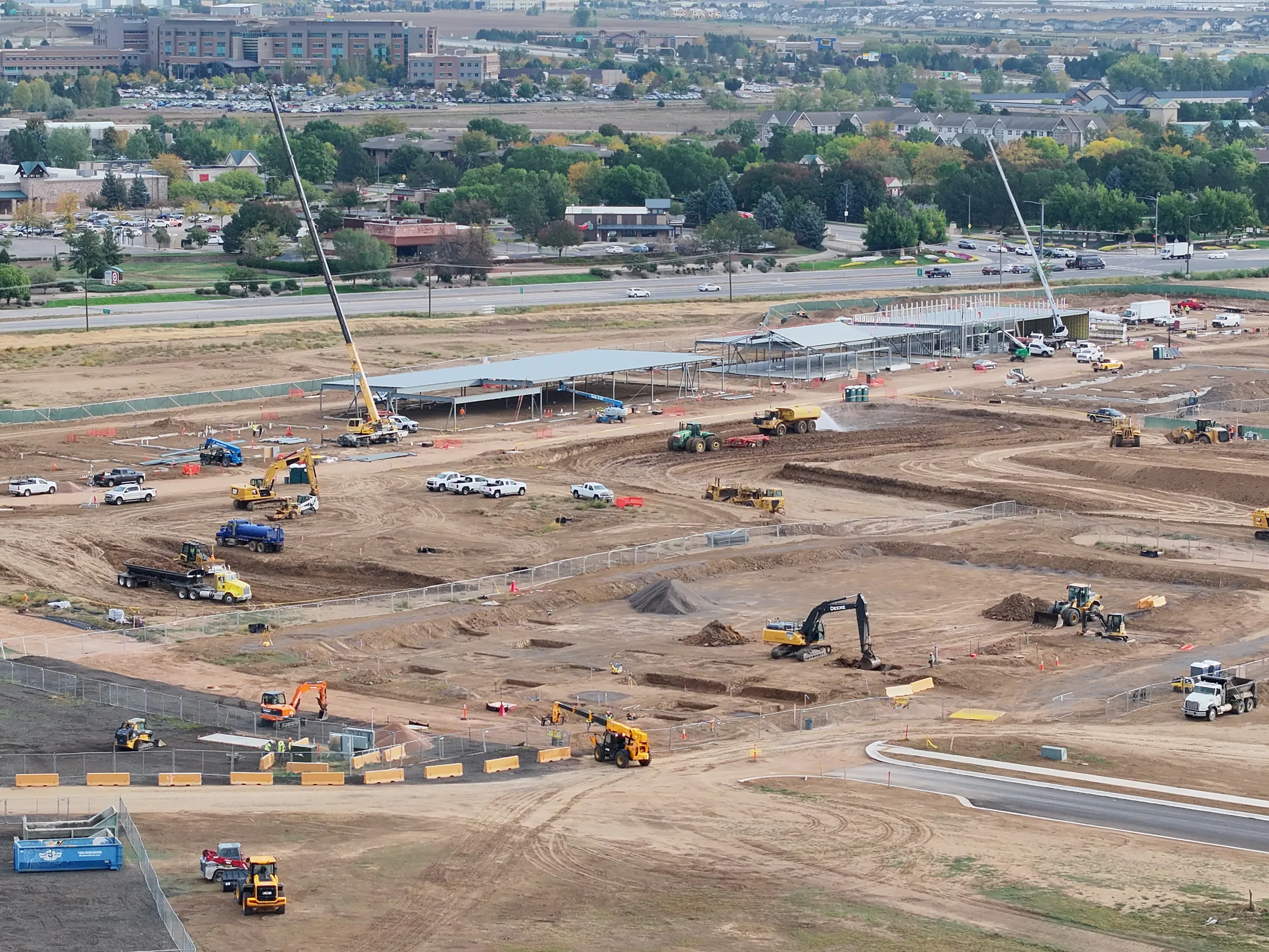
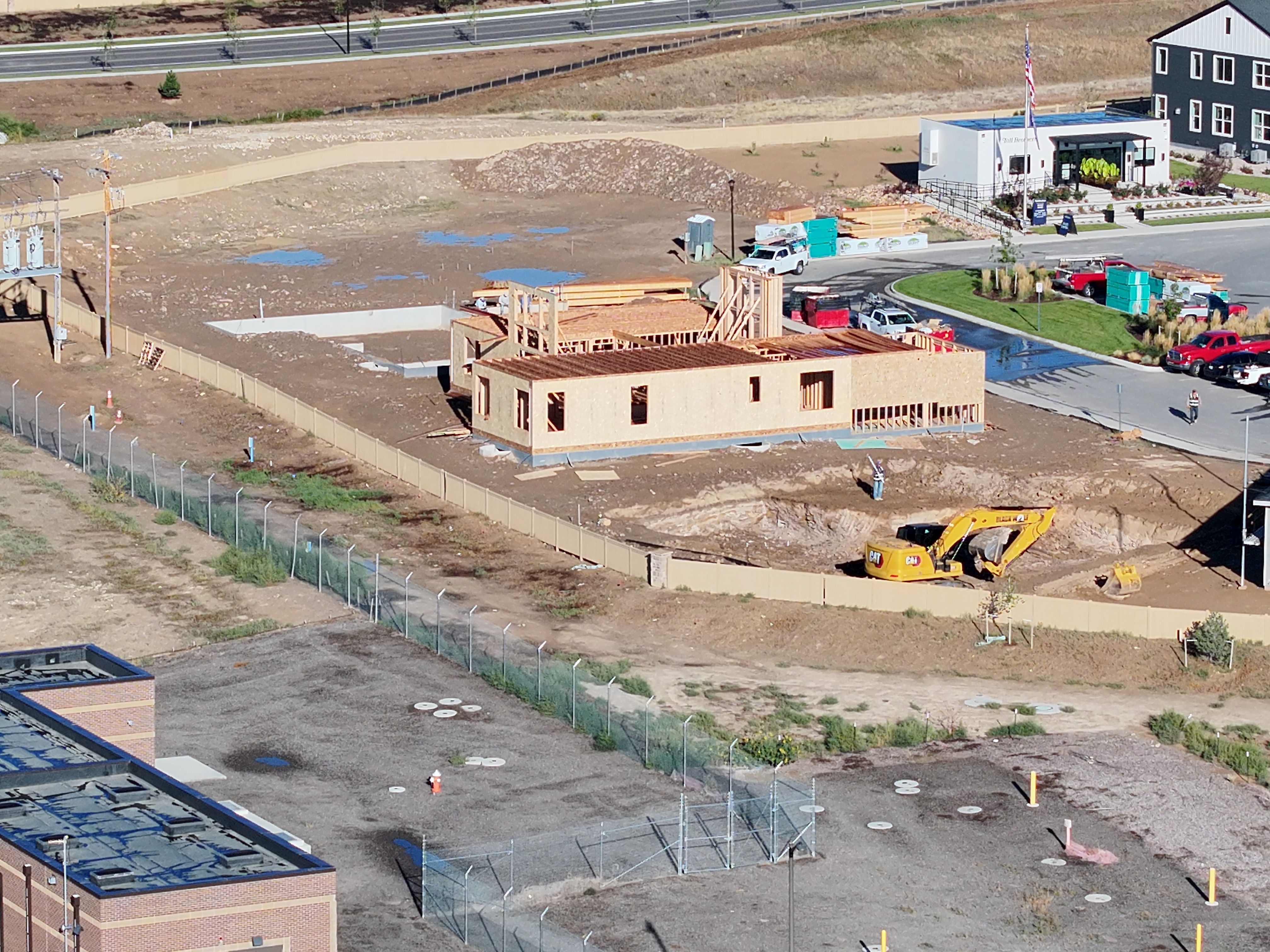
Four dated visits document the same commercial construction site. The September 28 update records steel buildings and roof covering alongside wall framing, crane activity, excavation and grading. Paired overviews and closer work-area views connect visible changes across visits with the wider jobsite, creating a visual record for project reporting.
Coverage timeline: September 9 → September 15 → September 22 → September 28, 2026. Repeated coverage documents the same work areas; camera positions vary between visits.
Earthwork and equipment · September 22 → September 28
ANGEL EYE VIEWSeptember 22, 2026 · Active earthwork and equipmentANGEL EYE VIEWSeptember 28, 2026 · Active earthwork and equipment
Demonstration 2 · September 2, 10, 21 & 28, 2026
Residential Construction Progress
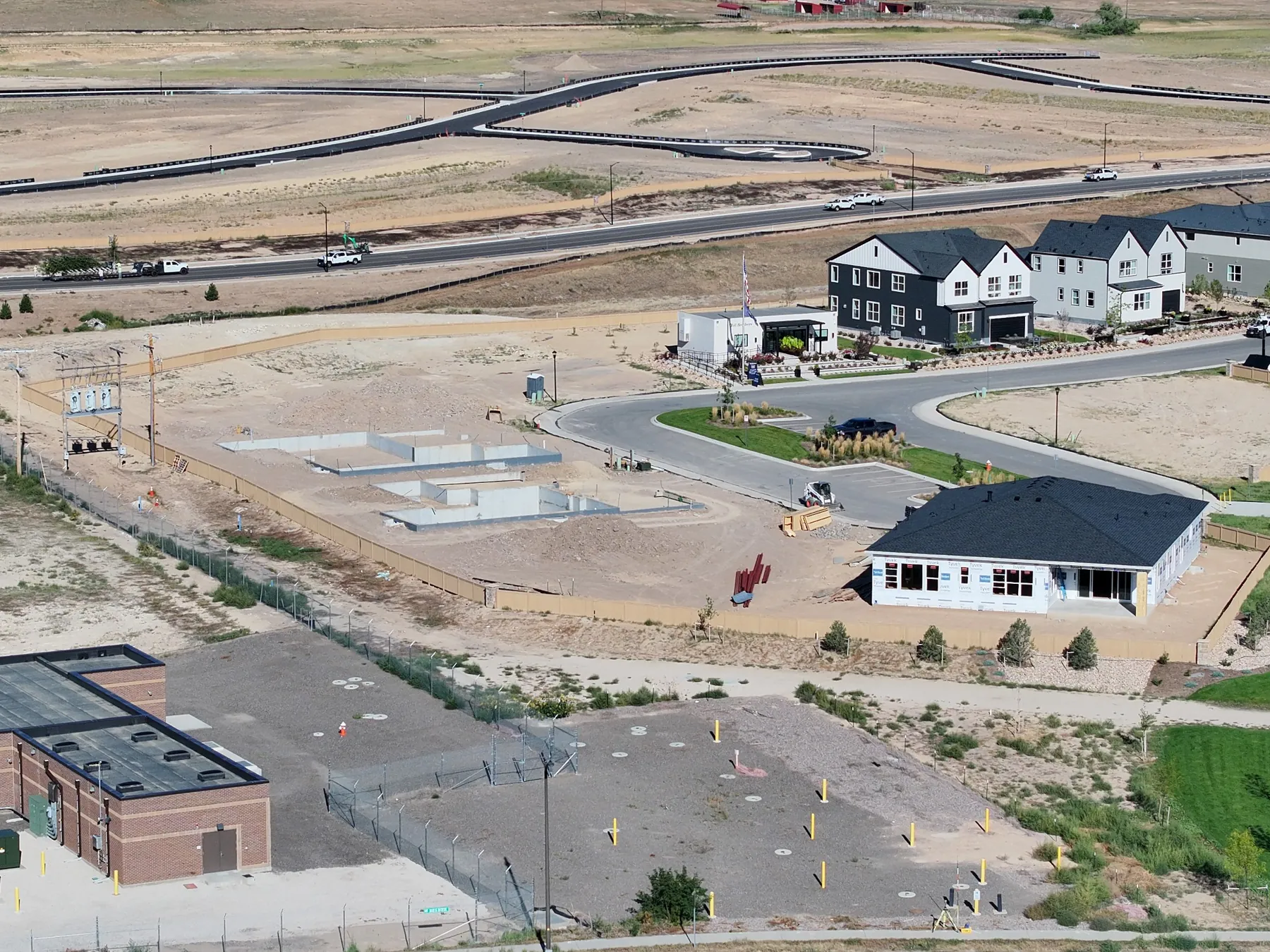
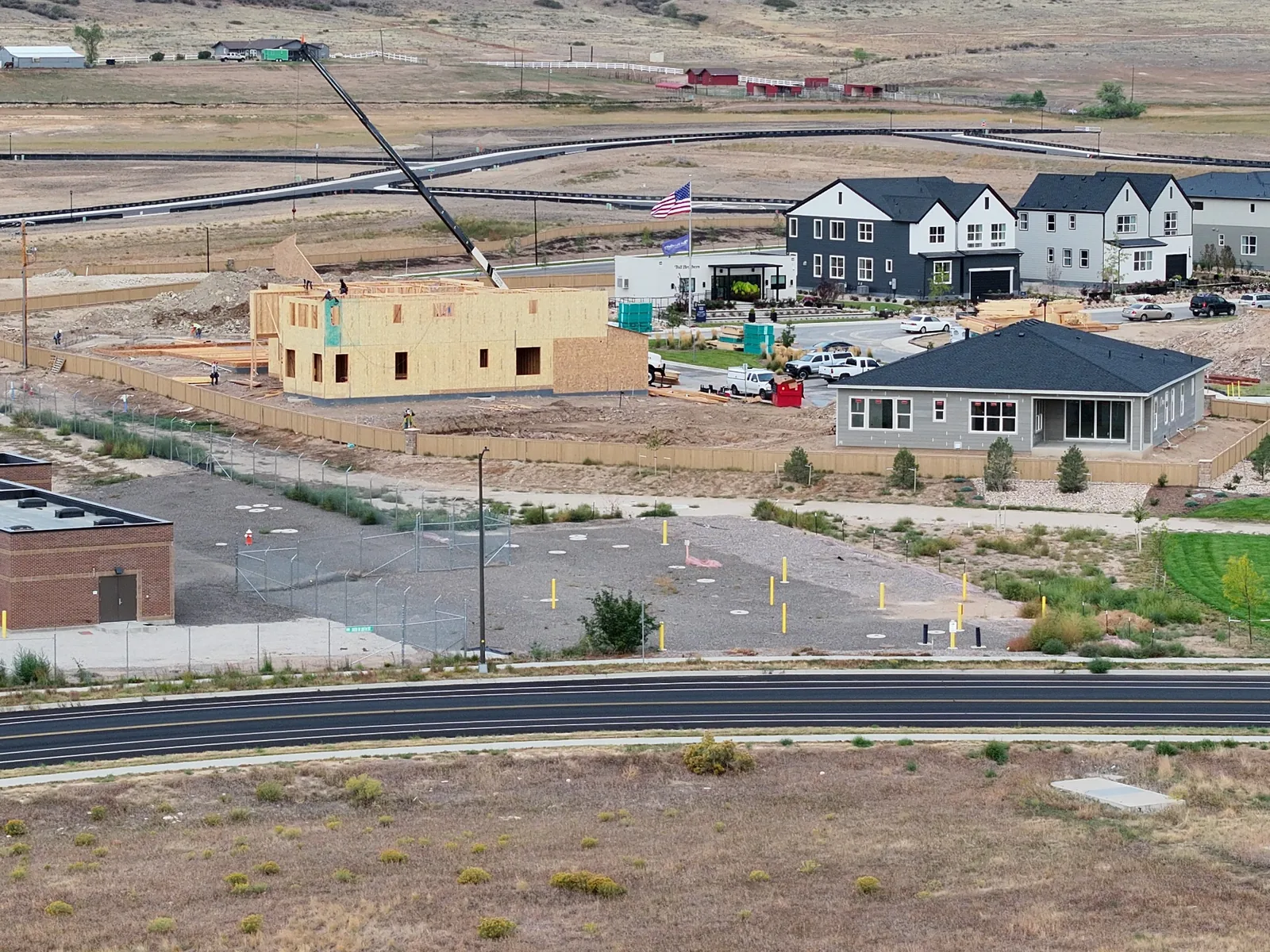
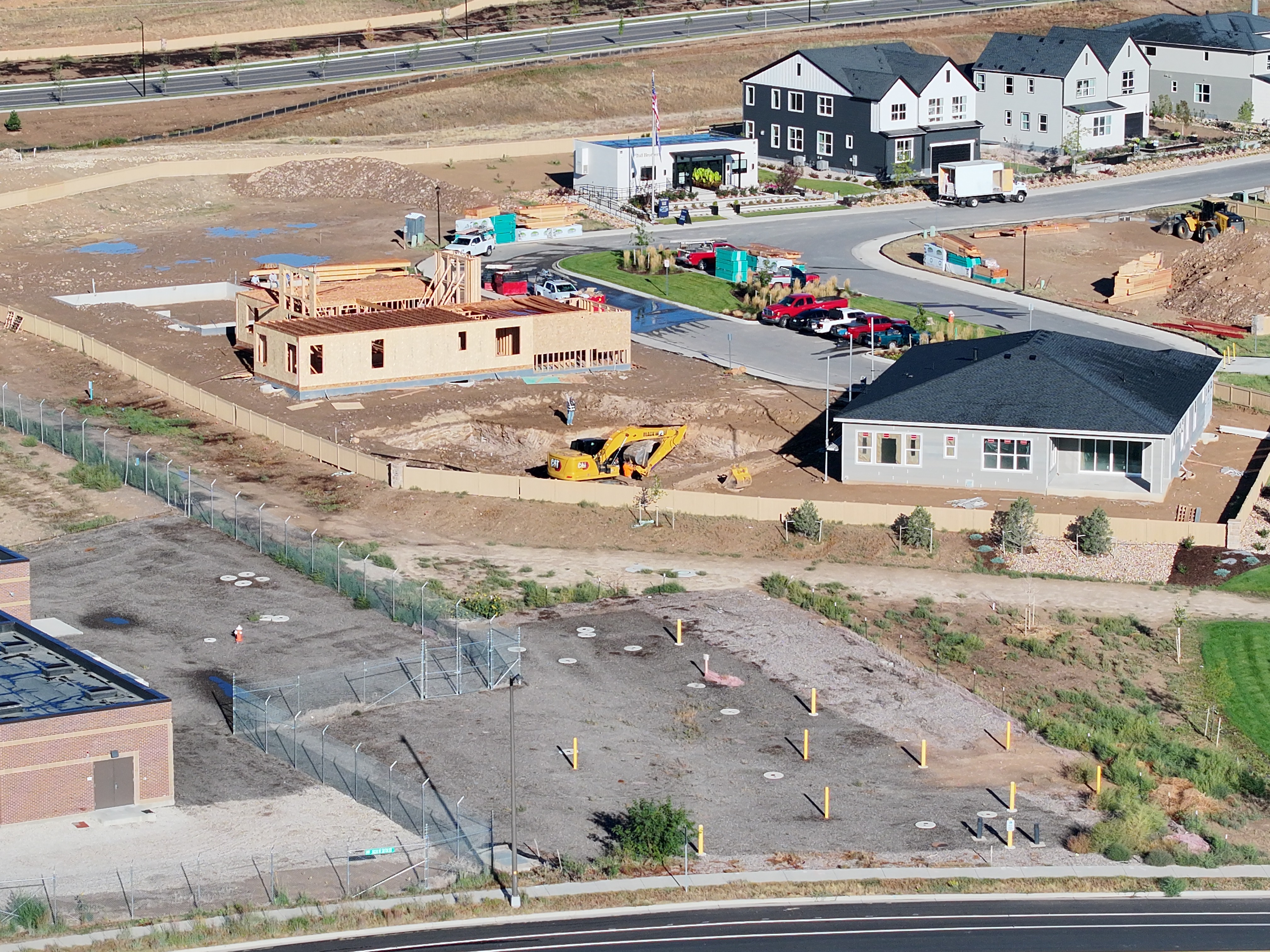
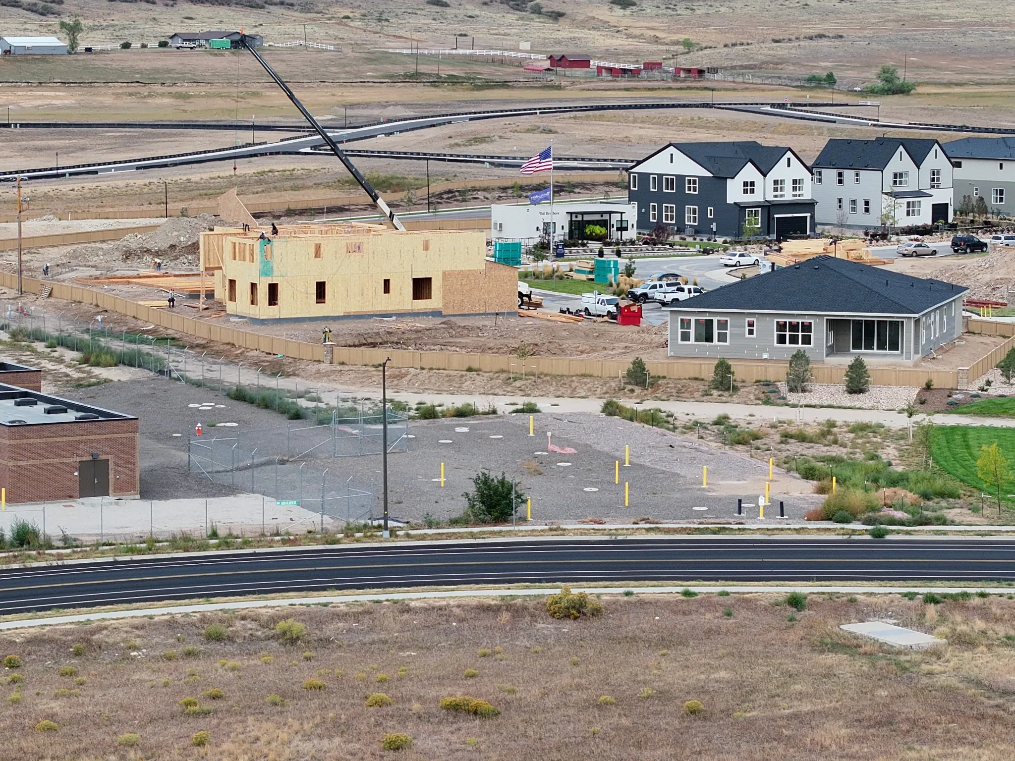
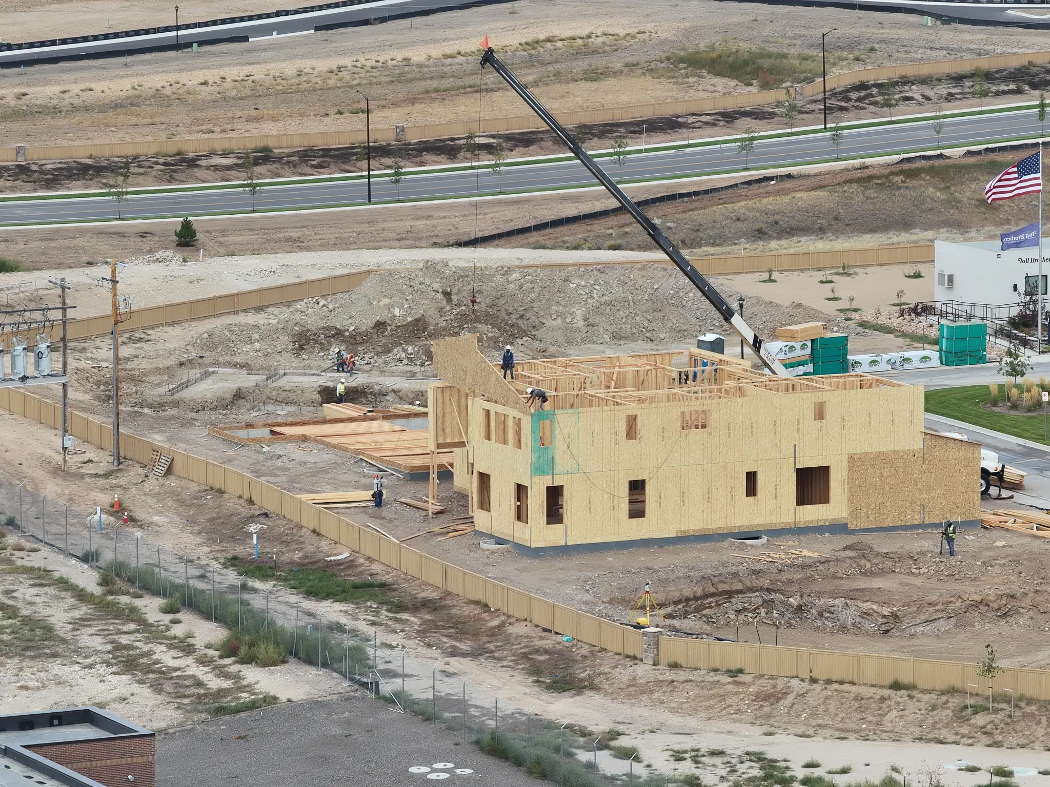
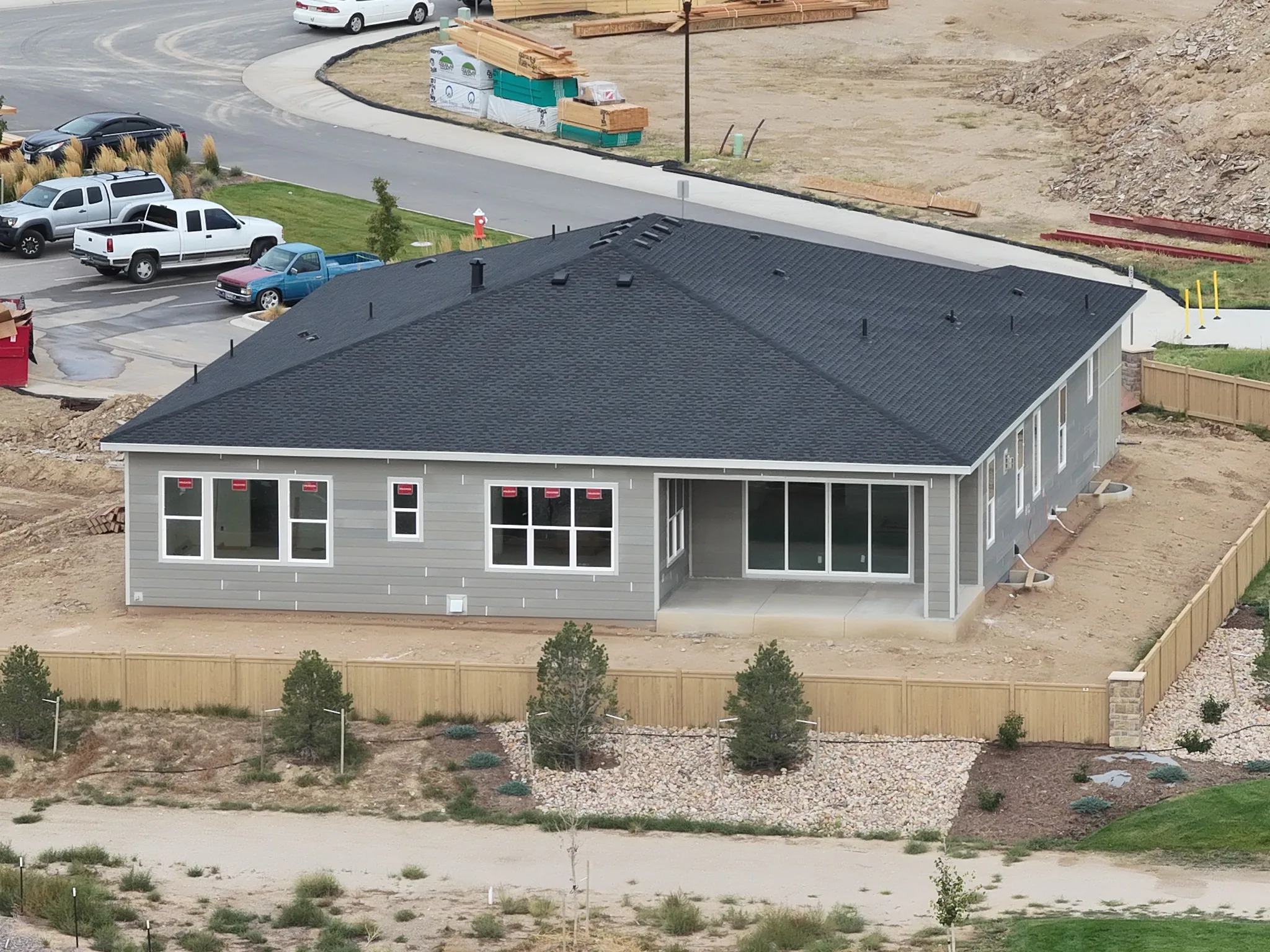
Four dated visits document the same residential construction site. Earlier views record roof covering and initial framing; the September 28 update shows taller sheathed walls, upper framing and crane activity. Paired overview and detail photographs make visible changes easier to compare across visits, while keeping the surrounding work areas in context.
ANGEL EYE VIEWSeptember 2, 2026 · Roofing in progressANGEL EYE VIEWSeptember 10, 2026 · Shingle covering in place
Coverage timeline: September 2 → September 10 → September 21 → September 28, 2026. Repeated coverage of the same work areas builds a visual record for project reporting; camera positions vary between visits.
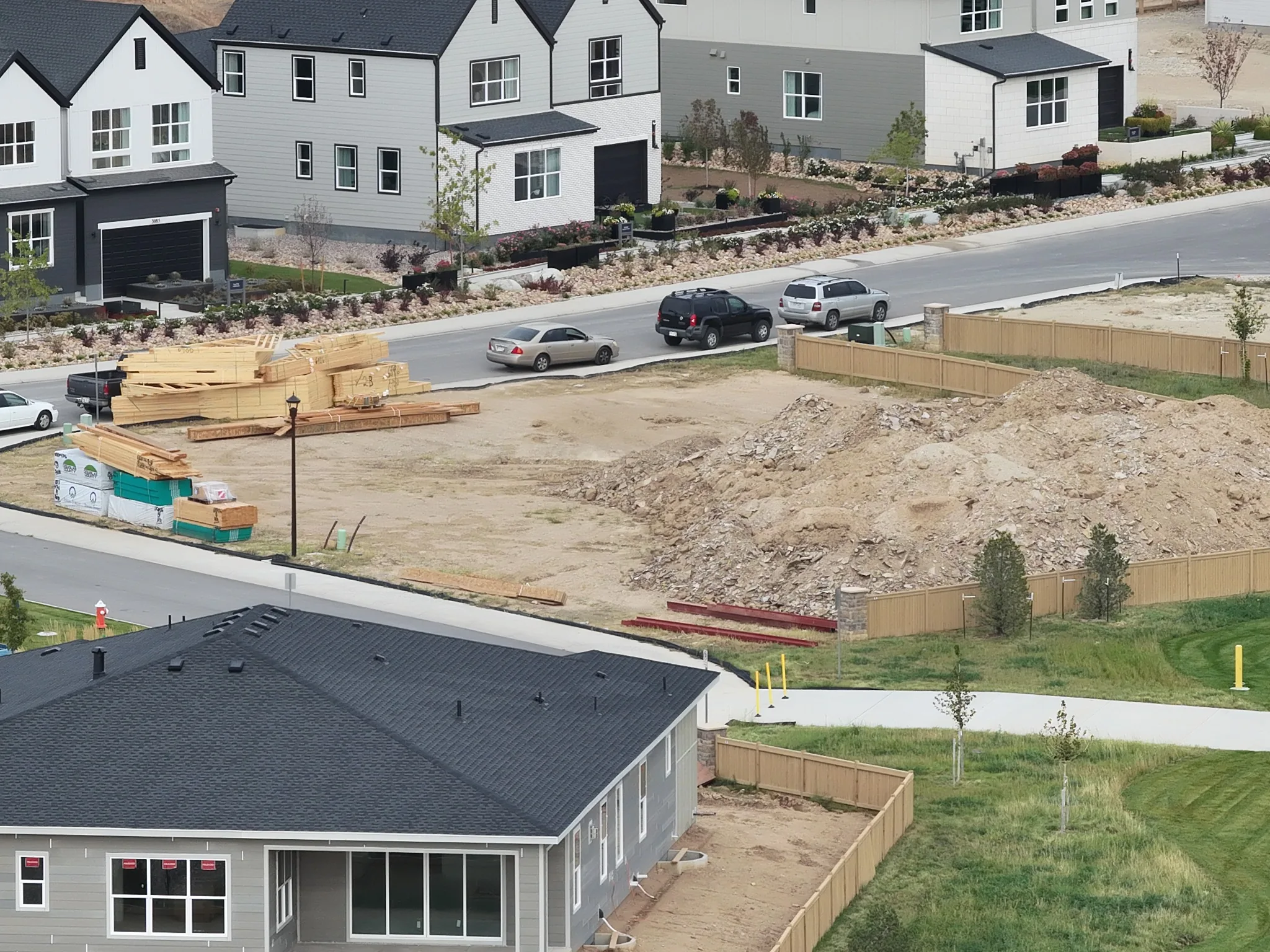
Site overview · September 21 → September 28
ANGEL EYE VIEWSeptember 21, 2026 · Site overview and construction progressANGEL EYE VIEWSeptember 28, 2026 · Site overview and surrounding construction
Framing progress · September 21 → September 28
ANGEL EYE VIEWSeptember 21, 2026 · Active framing and site workANGEL EYE VIEWSeptember 28, 2026 · Wall sheathing, upper framing and crane activity
Latest visit details · September 28
ANGEL EYE VIEWSeptember 28, 2026 · Roof and exterior conditionANGEL EYE VIEWSeptember 28, 2026 · Staged materials and adjoining work area
Demonstration 3 · Earthwork documentation
Earthwork & Site Development
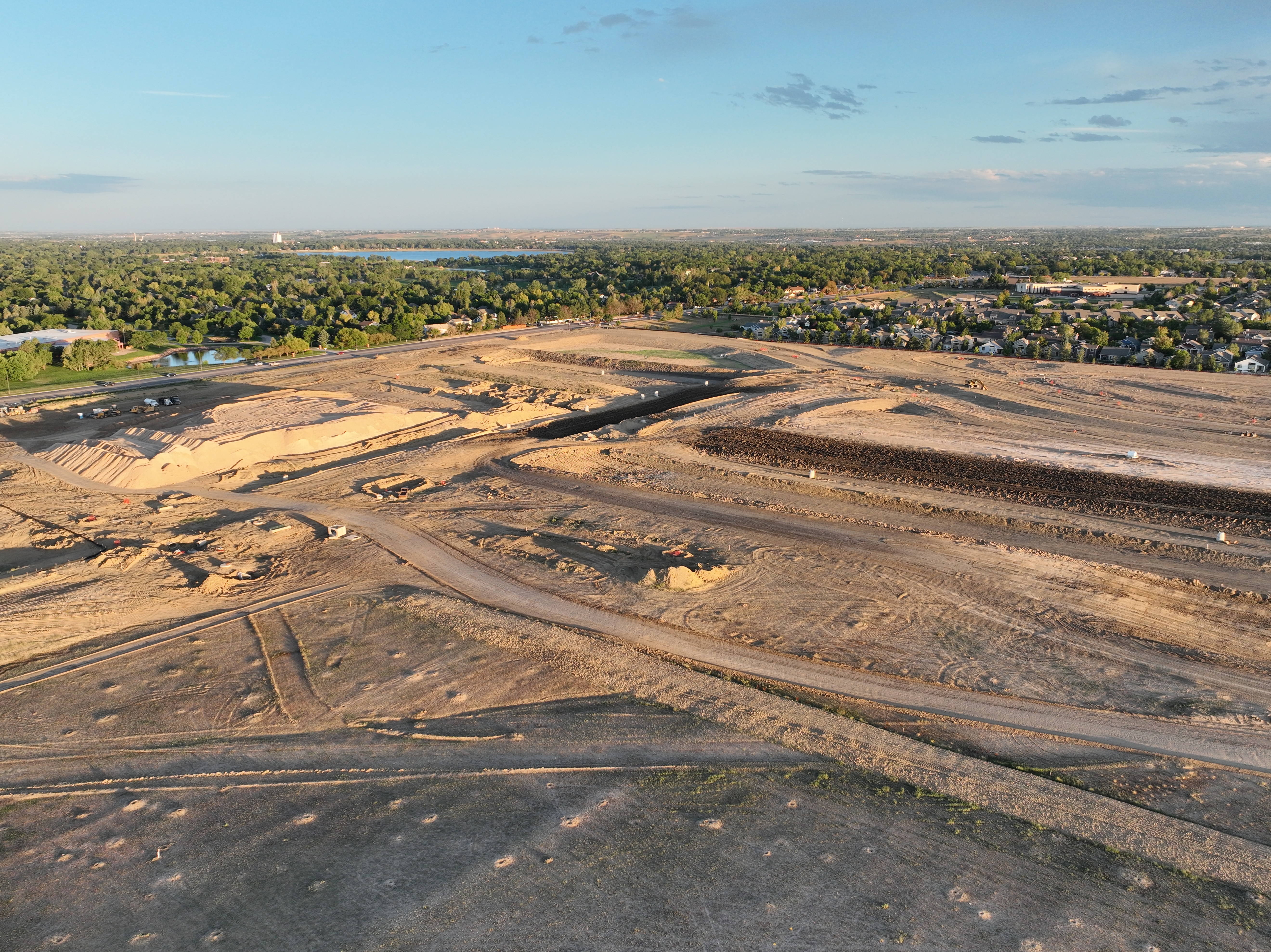
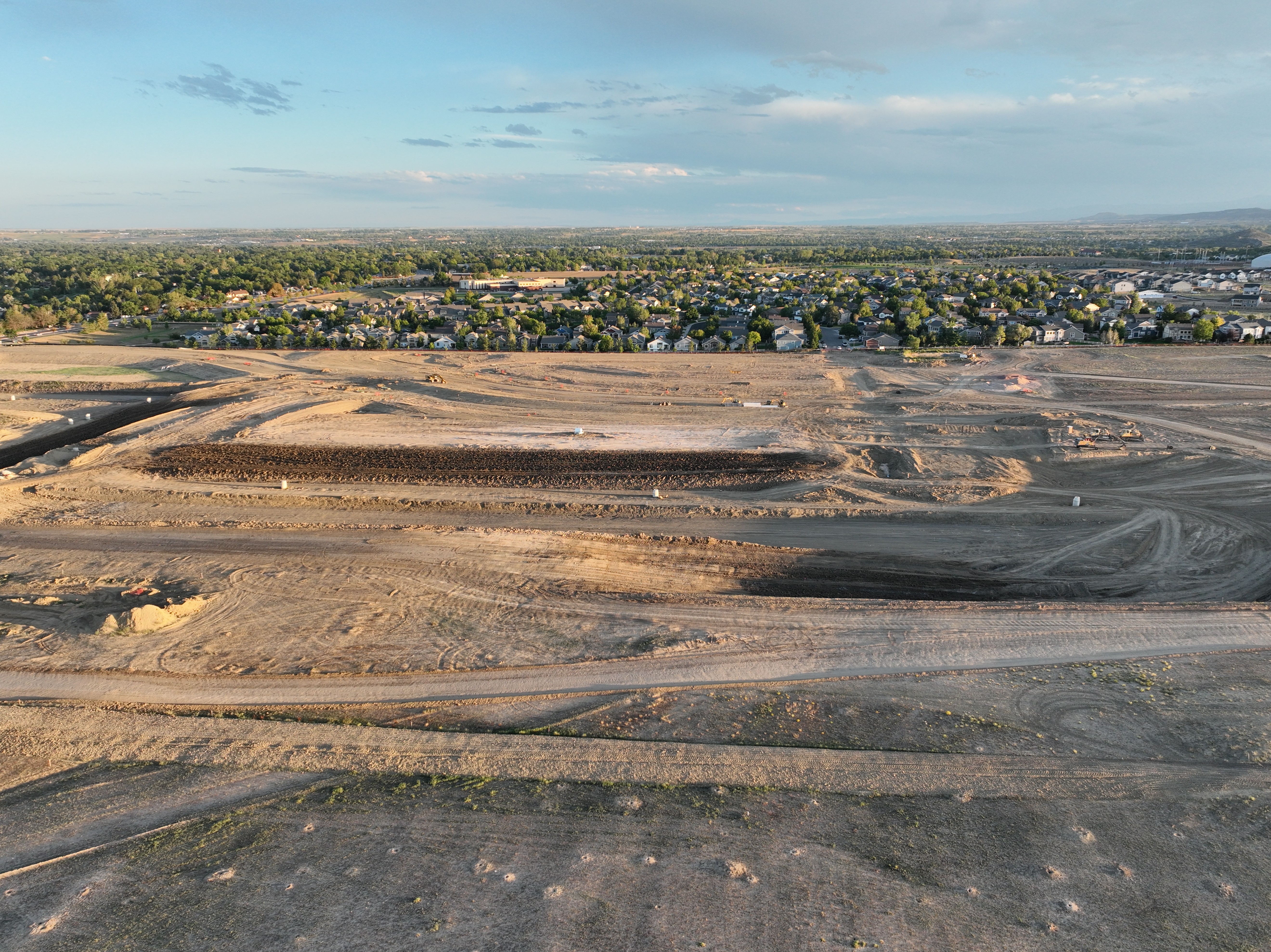
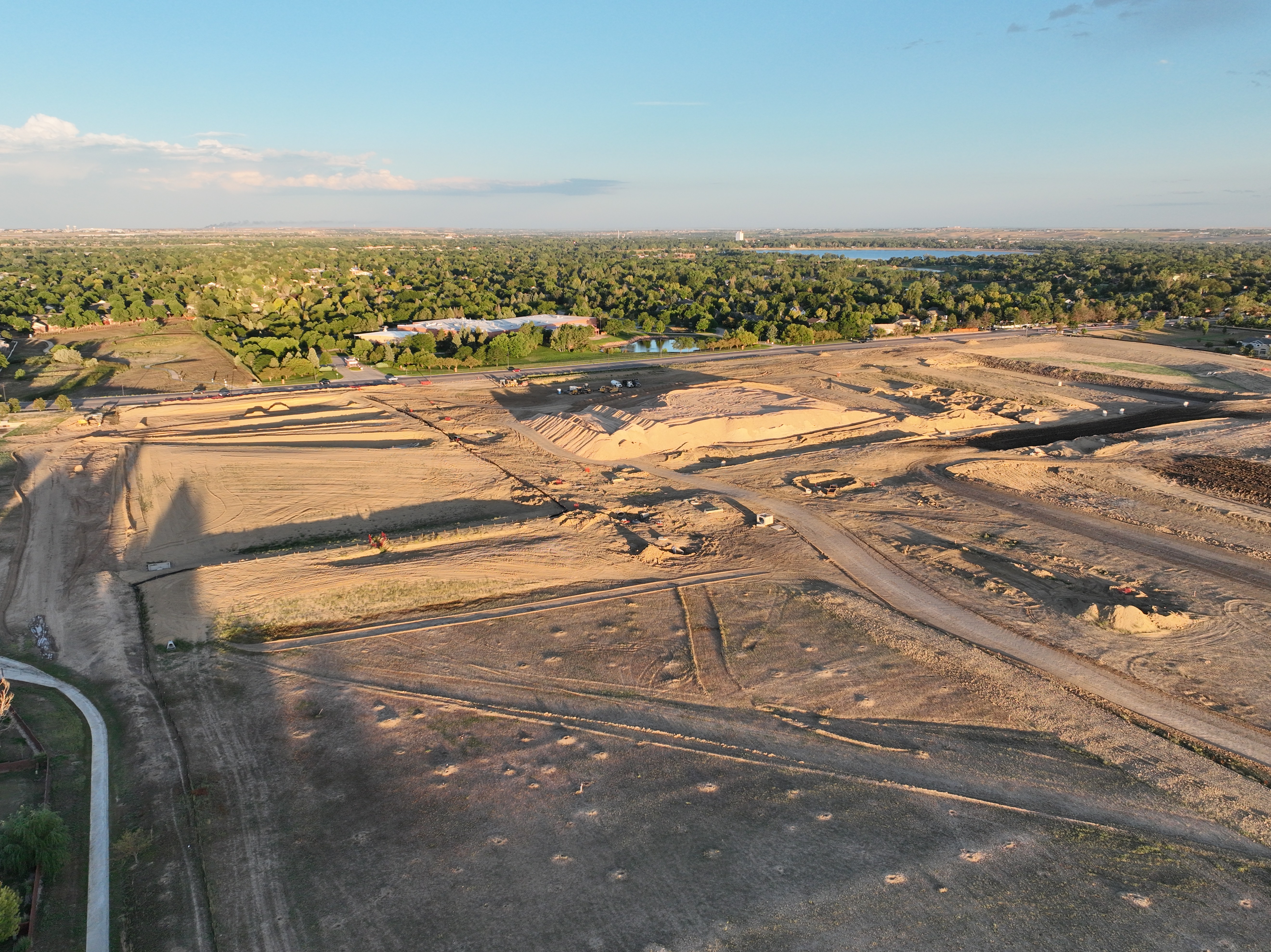
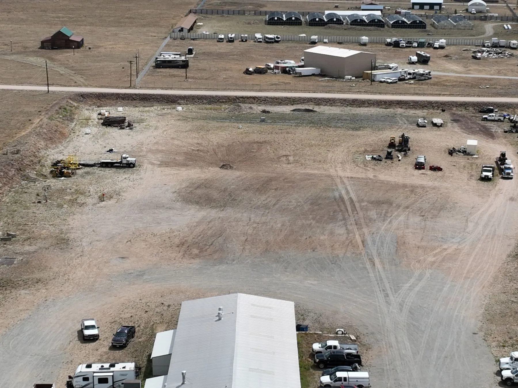
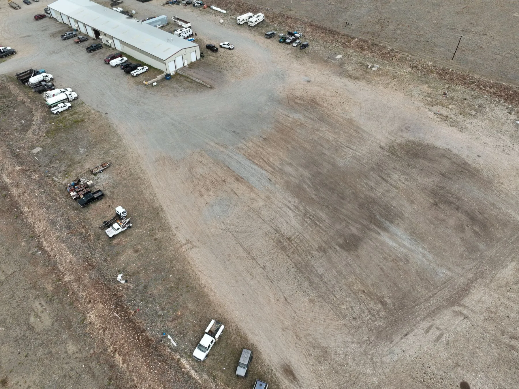
Wide aerial perspectives show the scale of site preparation and its relationship to the surrounding neighborhood. These views establish a visual baseline for future captures as work advances.
Earthwork & site development · Aerial video overview
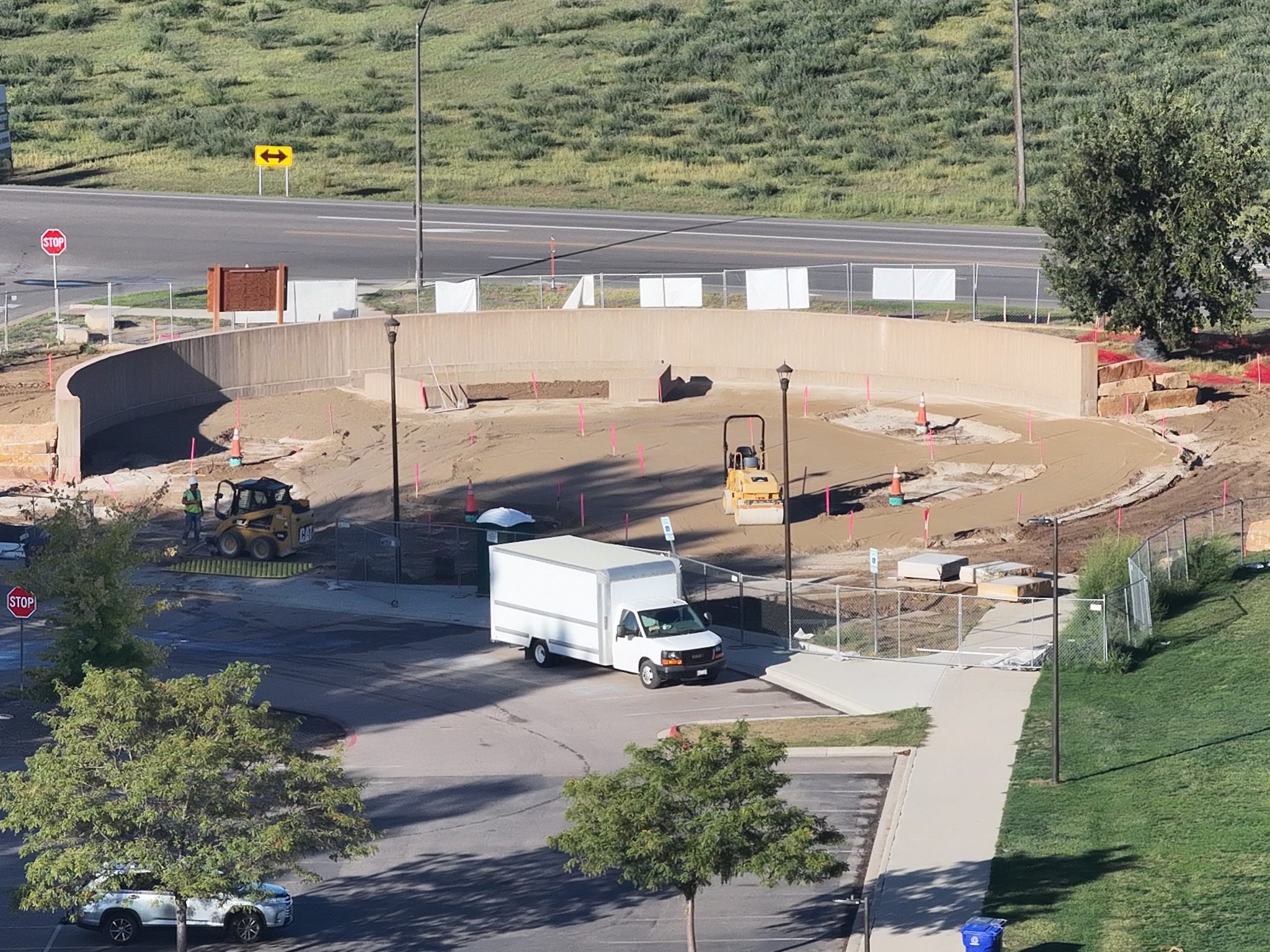
A closer aerial view records the curved structure and adjoining work area at a separate site. This dated view shows how focused coverage can document a specific part of a project while retaining the surrounding access and site context.
ANGEL EYE VIEWSeptember 22, 2026 · Curved structure and surrounding work area
Plan the capture around your project.
Angel Eye View offers aerial site documentation, recurring progress capture, orthomosaics, 3D modeling, and UAV data collection. We can scope the flight plan, capture frequency, and deliverables around your team's reporting and visualization needs.
These demonstrations show aerial photography. Orthomosaics and 3D models require separately planned capture and processing.
Turnaround: Turnaround is confirmed with each quote, based on the deliverables and editing required.
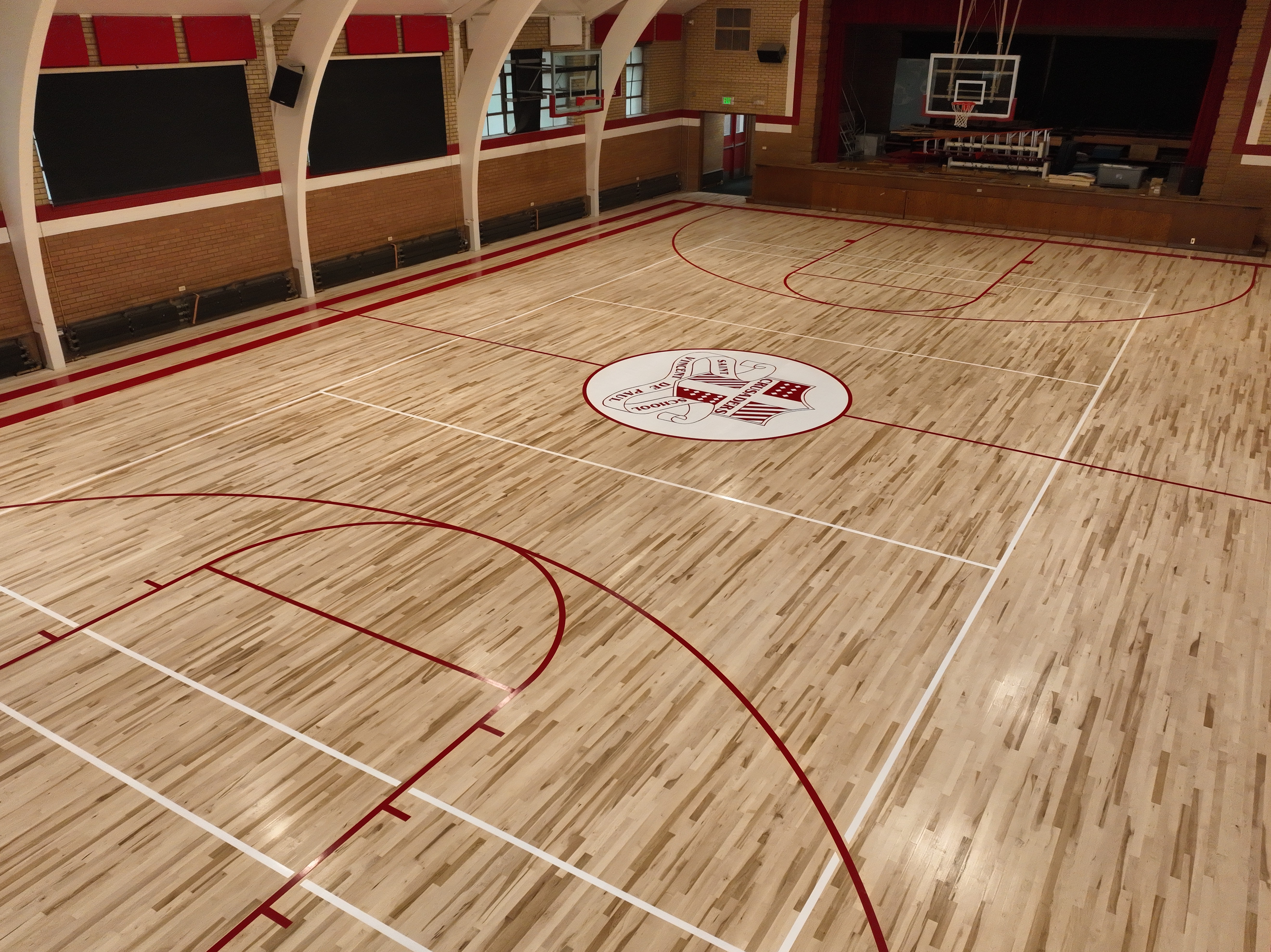
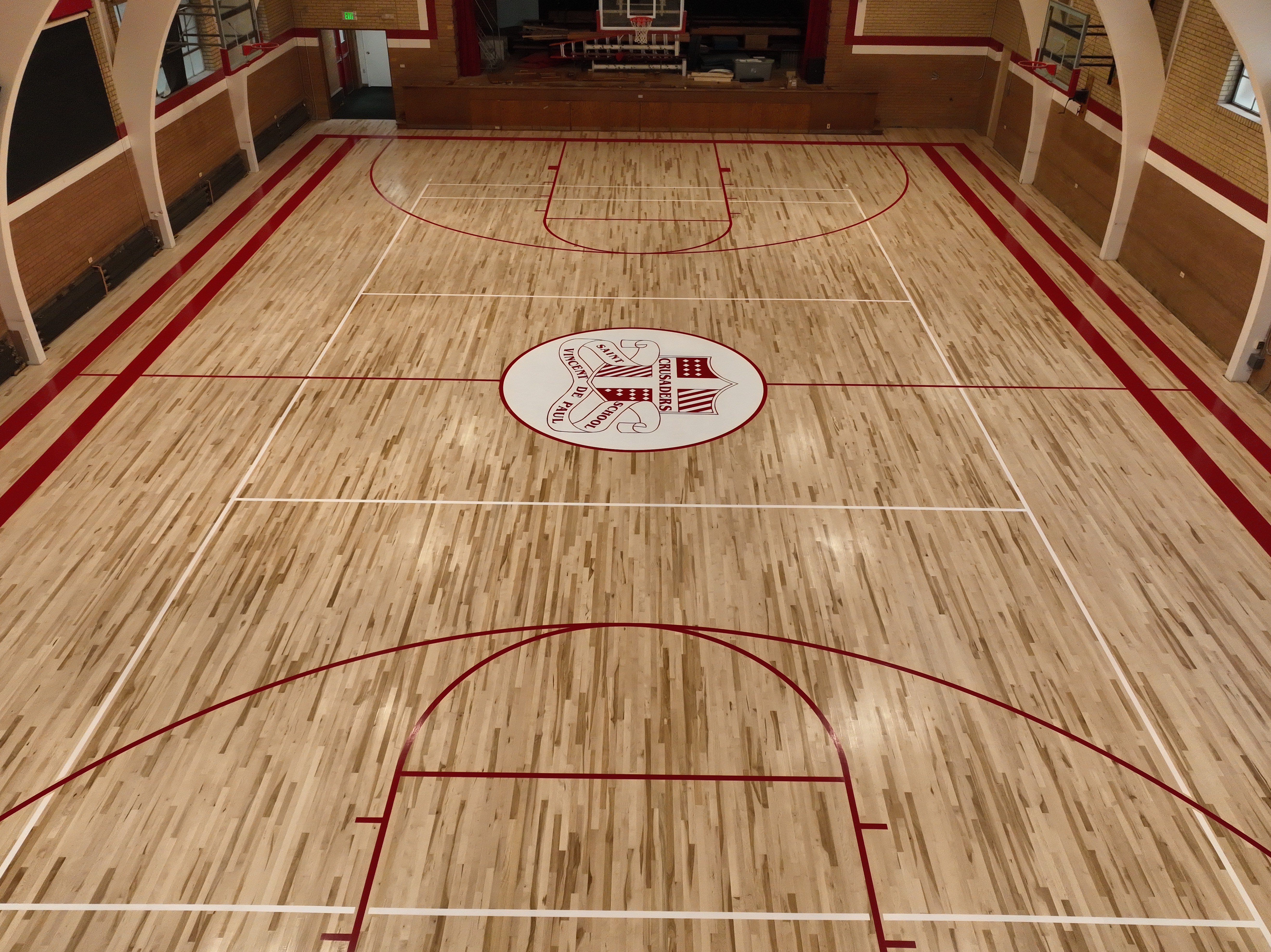
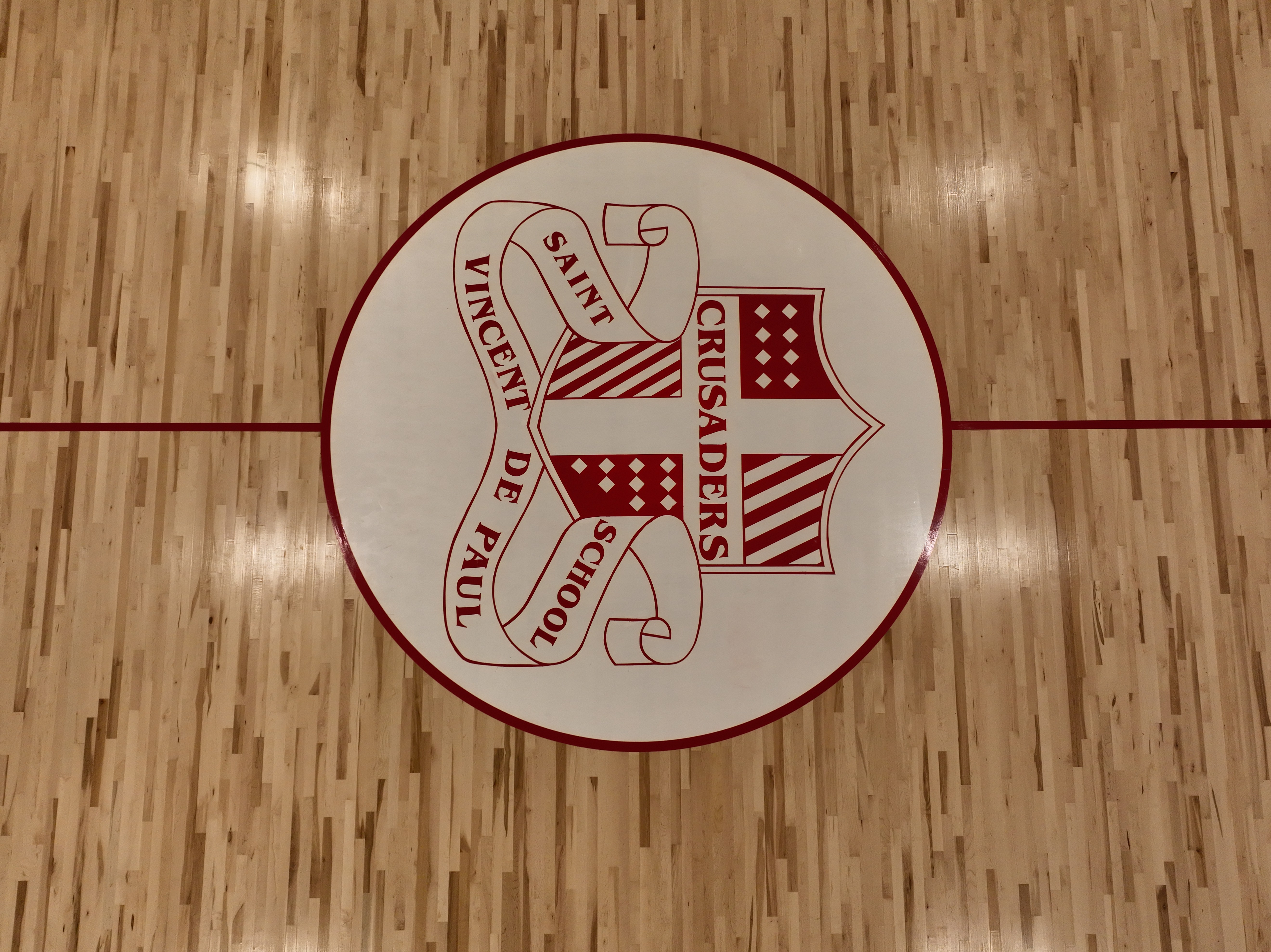
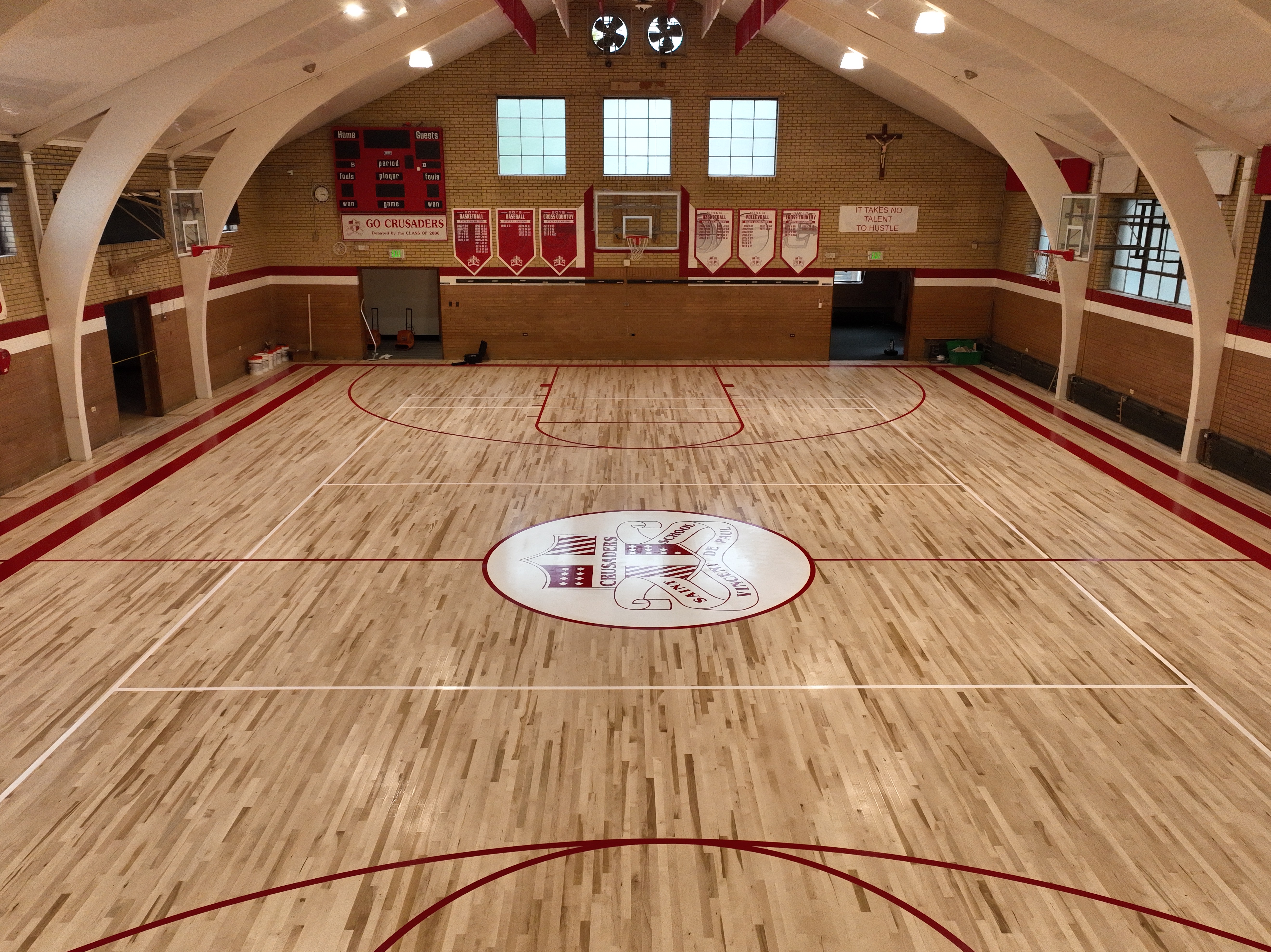
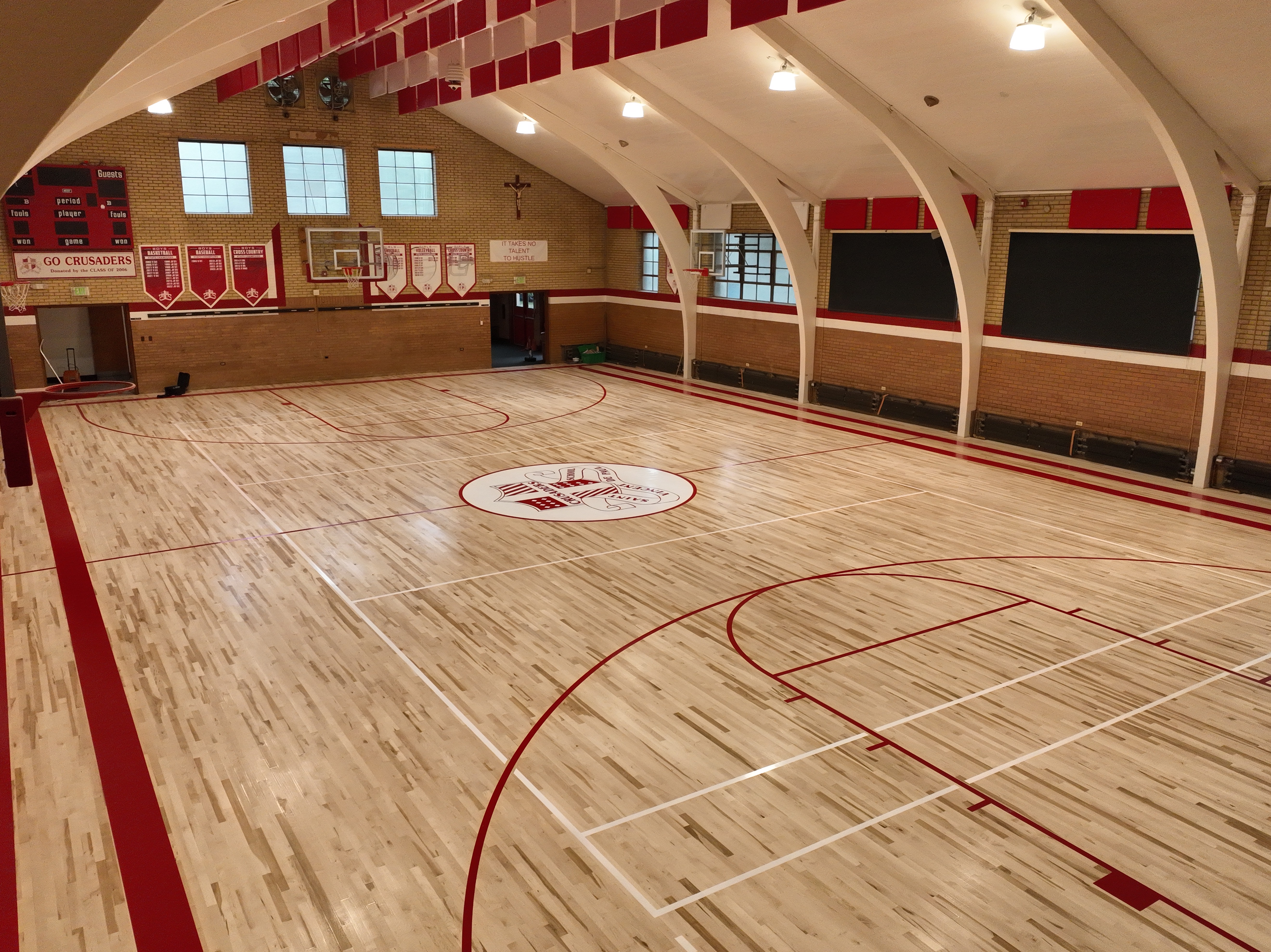
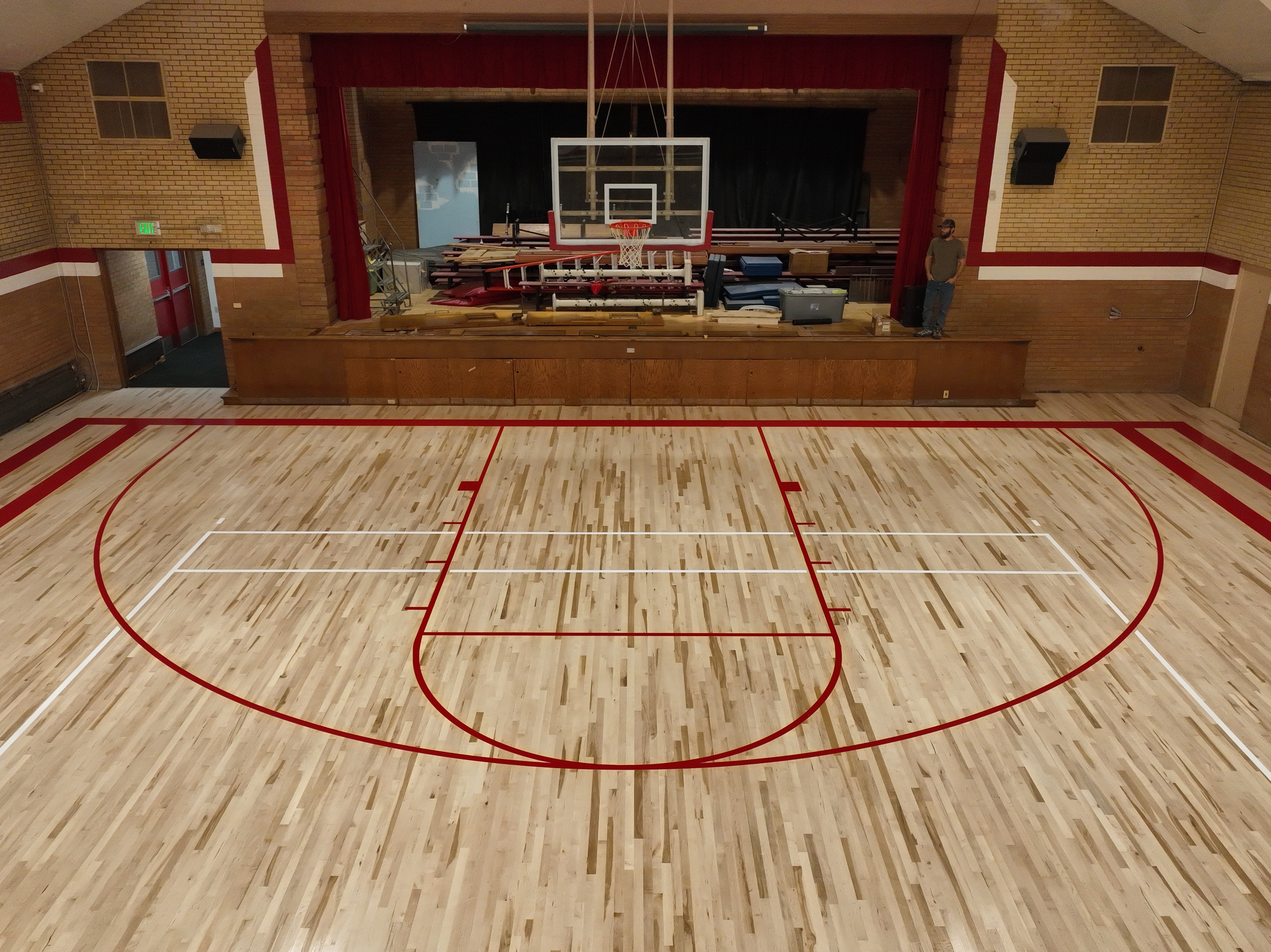
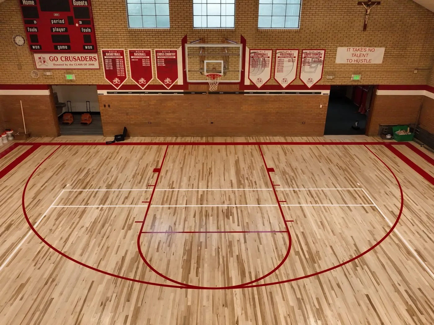
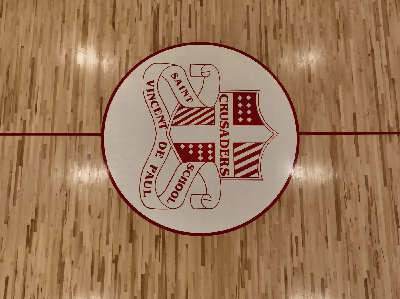
High-resolution indoor aerial imagery documents the completed court as a whole, the center-court crest, and the finished floor from multiple viewpoints. Captured at Saint Vincent de Paul School in Northern Colorado with permission to share, this completed project shows how Angel Eye View documents institutional renovation work.
Real captures across Northern Colorado, from georeferenced mapping and aerial data collection to interior detail. Captured by Angel Eye View, with processing performed in-house or delivered for client workflows as required.
NORTHERN COLORADO
01
Mapping & Data Collection
Georeferenced mapping, aerial data acquisition, and 3D reconstruction for commercial projects.
Commercial site · UAV data acquisitionDATA COLLECTION
Commercial site · aerial overviewSITE DOCUMENTATION
The angle a phone can't reach. High-resolution stills and stabilized 4K video for listings, marketing, construction progress, and events, color-graded and delivered in the formats you actually use.
Built for the way you publish
01
Real estate & propertyListing hero shots, lot context, and walkthrough video that make a property read at a glance.
02
Marketing & brandCinematic reveals and social-ready clips cut to length for web, reel, and portfolio.
03
Events & communityWide-scale coverage of gatherings, venues, and celebrations from a vantage nothing on the ground can match.
04
Progress documentationRepeatable capture angles that track a project month over month.
AERIAL · STILLDELIVERY READY
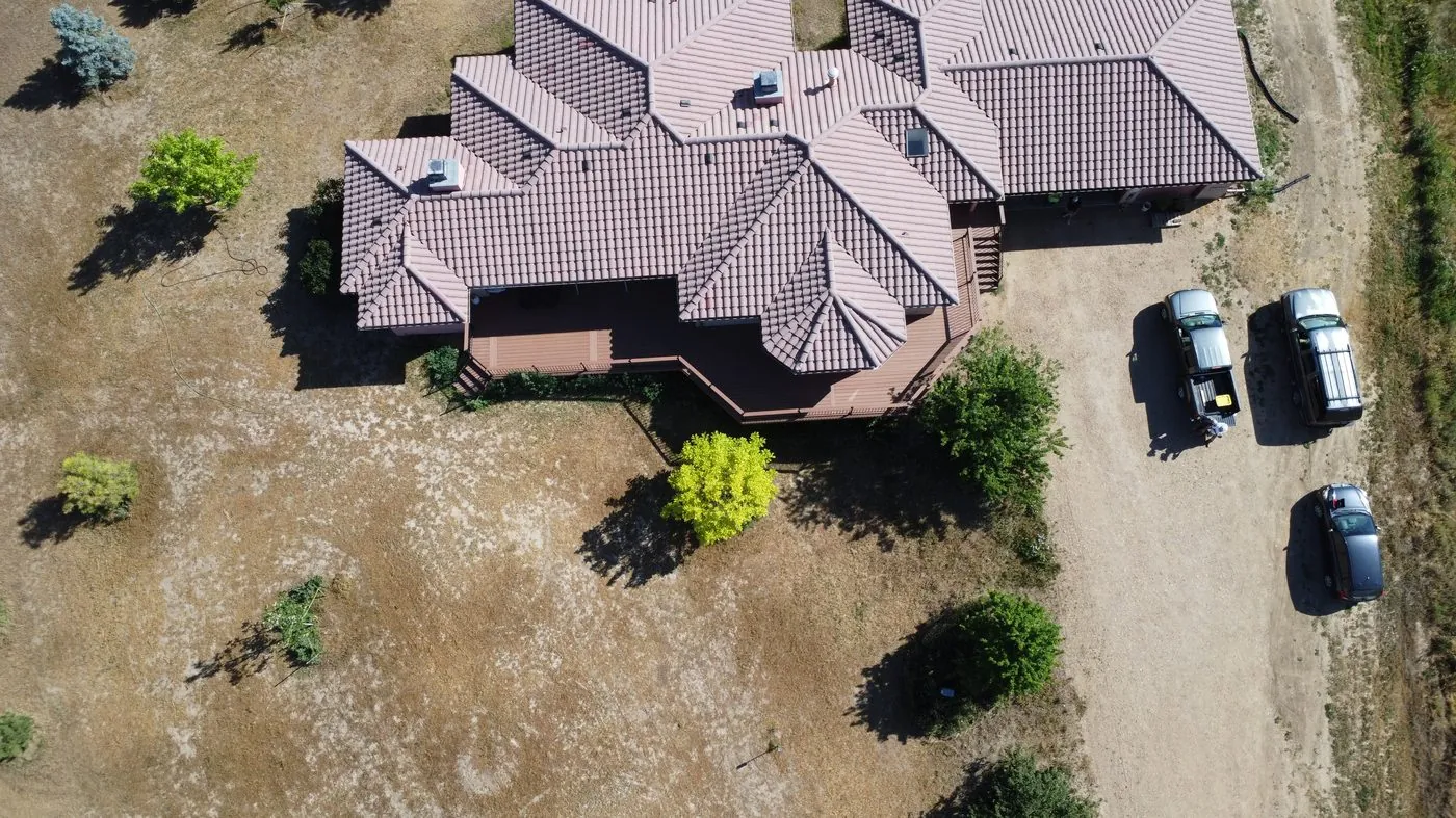
Residential property · top-downREAL ESTATE
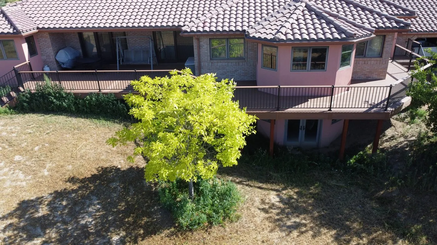
Exterior · low angleMARKETING
Property overviewPORTFOLIO
Turnaround
Turnaround is confirmed with each quote, based on the deliverables and editing required.
Licensing
Full commercial usage rights delivered with every project.
Drone mapping in Loveland. Site context in 2D and 3D.
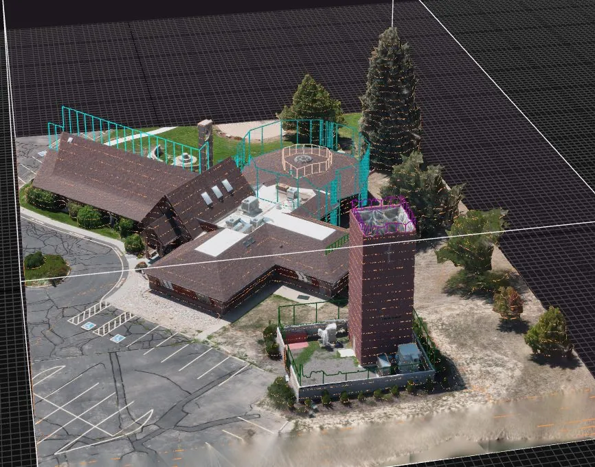
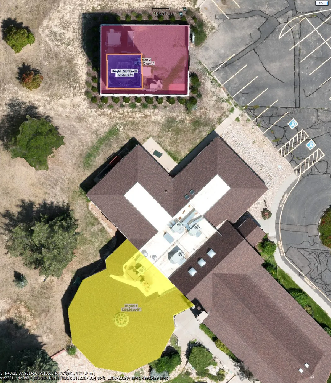
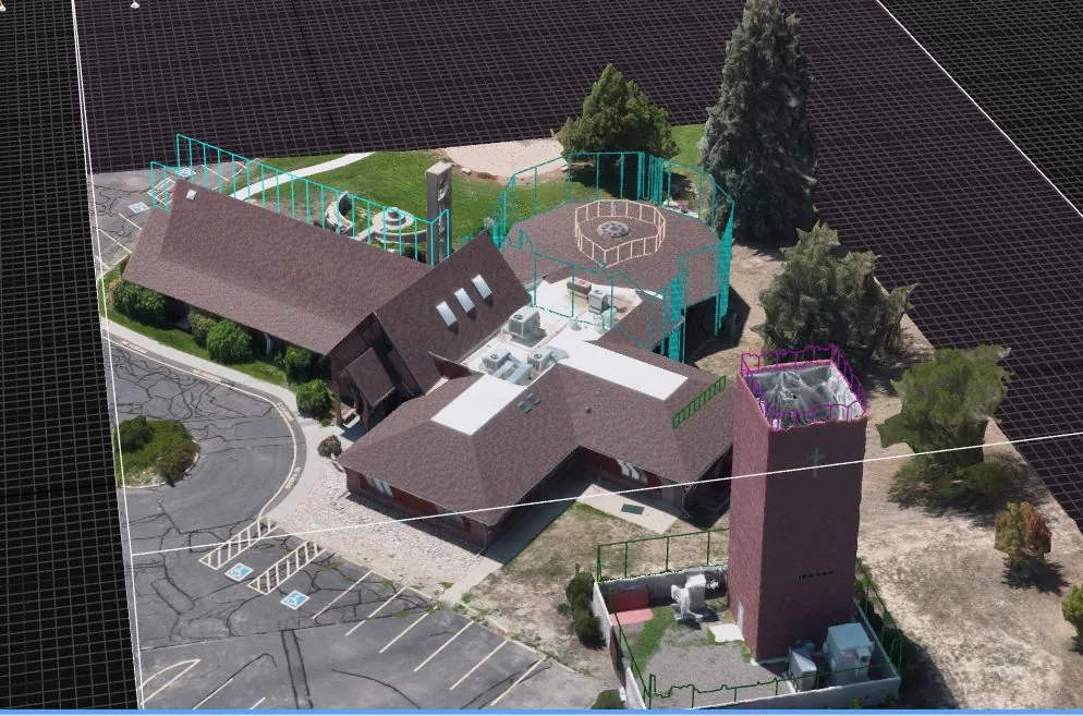
Angel Eye View provides aerial mapping and data collection in Loveland and Northern Colorado. Planned drone flights produce imagery for georeferenced orthomosaics, point clouds, and textured 3D models, or datasets for a client’s existing photogrammetry workflow. Deliverables support site documentation, visualization, and project review.
ORTHOMOSAIC · 2DSITE CONTEXT
Example output · software-generated annotationsILLUSTRATIVE OUTPUT
3D MODEL · POINT CLOUDTEXTURED
Reconstructed geometry · full structure3D VISUALIZATION
What you receive
◇
Orthomosaic mapsStitched, georeferenced top-down imagery for site context, exported for print or GIS.
◇
Point cloudsDense 3D datasets for site visualization and client review.
◇
3D textured modelsFull reconstructions for visualization, planning, and stakeholder review.
◇
Aerial data collectionPlanned image datasets for your processing workflow, with capture requirements agreed before flight.
Delivery planning
Reference system
Agreed for each project and documented with delivery
Capture plan
Coverage and image requirements scoped before flight
Intended use
Site documentation, visualization, and project review
Units
Imperial or metric deliverables
Processing
Encrypted local workstation, no public upload
Exports
GeoTIFF · LAS/LAZ · OBJ · PDF
Every deliverable is audited before release and never shared to third-party servers without written authorization.
▱
Land & property
Aerial site context and land-cover visualization for project planning.
⏛
Construction
Site overviews, visible earthwork changes, and progress documentation over time.
◉
Planning & design
Orthomosaics and 3D context for project discussions and visualization.
Angel Eye View does not provide land surveying or establish property boundaries. Mapping products are for documentation and visualization; no survey-grade or independently verified positional accuracy is represented. Any measurement-dependent use requires validation by the appropriate qualified professional.
Drone visual inspections in Loveland and Northern Colorado provide close-up imagery of roofs, signs, and hard-to-reach structures. Document visible conditions for maintenance planning and project records, with access and flight requirements assessed for each site. Imagery supports review by your team and does not replace a specialist’s structural or engineering assessment.
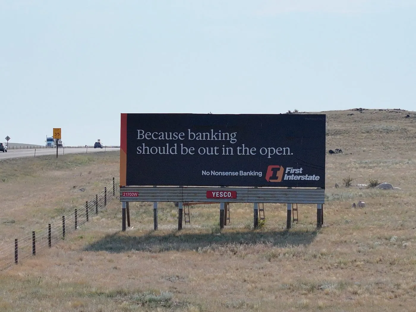
SIGNAGE · DETAILSAFE STANDOFF
Highway signage · documentationNO LIFT REQUIRED
Safer, faster, documented
On complex commercial and industrial sites, Angel Eye View deploys visual observers and flies within line of sight to keep every inspection controlled and compliant.
✓
Roof & facadeDocument shingles, membranes, flashing, and cladding without setting foot on the surface.
✓
Signage & structuresInspect billboards, towers, and tall structures a technician can't safely reach.
✓
Interior & detailHigh-resolution interior capture for facilities, courts, and finished spaces.
✓
Insurance & claimsTime-stamped, high-resolution documentation for records and reporting.