
Construction progress monitoring.
A dated visual record of your jobsite, from the overall site to the work areas that matter. Angel Eye View LLC provides recurring aerial construction photography for contractors in Loveland, Fort Collins, Greeley and Northern Colorado.
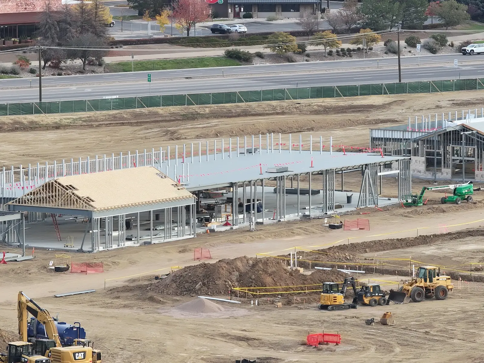
A clear record. Every month.
Keep your team and stakeholders up to date with one straightforward monthly package for your jobsite.
Monthly Progress Package
- One scheduled site visit per month
- 12–20 aerial progress photos per visit
- Consistent, repeatable angles to compare progress over time
- A one-page progress summary with each monthly update
- Organized digital delivery for your records and project updates
Coverage and your quote are tailored to the project location, site size, and scope. Agree on viewpoints before the first visit; flights and repeat angles depend on weather, airspace, access, and site conditions.
This package covers aerial progress photography and a summary of visible changes. Orthomosaics and 3D models are separate services and are not included.
Call for a quote → Request monthly coverage →Keep the whole project in view.
Ground-level photos show individual details. Aerial photographs connect those details to the surrounding site, giving your team context for project updates and discussions. Recurring visits help you compare visible conditions as construction moves forward.
Site overviews
Establish the relationship between buildings, access routes, staging areas, and active work. Use wide views to orient people who are not on site.
Focused work areas
Document selected framing, roofs, foundations, and earthwork from agreed viewpoints, keeping the area of interest in its wider context.
Recurring progress records
Organize dated views across visits so your team can review visible changes and include imagery in project reporting.
Commercial steel construction, September 9 through October 25.
Eight dated visits document the same commercial site. Compare the October 16 and October 25 views to see changes in roof coverage, steel framing, foundations and site activity. This recurring aerial record helps project teams review visible progress between visits.
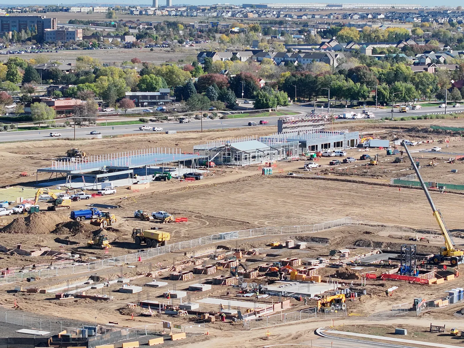
Independent demonstration photography, not a claim of a commissioned project or verified construction completion. These photographs document visible conditions; they do not establish measurements or certify work.
Explore the full dated construction series →Plan the capture around your reporting needs.
Define the scope
Share the project location, areas of interest, intended audience, and reporting schedule.
Agree on coverage
Set the viewpoints, visit frequency, and deliverables. Flight feasibility and access requirements are assessed for the site.
Document the site
Capture overall context and selected detail views. Repeat agreed viewpoints where site and flight conditions permit.
Review and share
Receive the agreed imagery organized for your records and project updates. Turnaround is confirmed with the quote.
See an example of the reporting format.
The sample progress report shows how aerial documentation can be presented for review. Your scope and deliverables are agreed for your project.
View sample progress report (PDF) ↗Supporting services for your jobsite
Pair recurring progress coverage with separately planned drone mapping and 3D modeling, visual inspection imagery, or scheduled live jobsite viewing. Agree on the intended use, capture plan, and deliverables before flight.
Questions before your first flight
How often should we capture?
The Monthly Progress Package includes one scheduled visit per month. If you need more frequent visits or milestone coverage, discuss a separate scope when requesting a quote.
Are maps included?
Progress photographs and mapping are different deliverables. Orthomosaics and 3D models require separately planned capture and processing.
Explore aerial mapping →Where do you work?
Angel Eye View is based in Loveland and serves Northern Colorado. Projects elsewhere in Colorado are available by arrangement.
Start with the project location.
Tell Chris Steingrube what you need documented, when you need it, and who will use the images. FAA Part 107 operations, with flight planning and processing handled by Angel Eye View.