
Drone mapping.
Site context in 2D and 3D.
Angel Eye View LLC provides aerial mapping, orthomosaics, 3D modeling, and aerial data collection in Loveland, CO and Northern Colorado. Turn a planned image capture into useful site context for documentation, visualization, and project review.
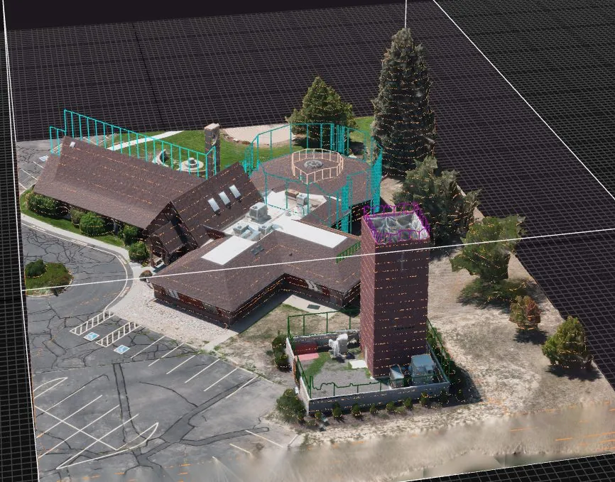
Choose the deliverable for the question.
A top-down map, a 3D model, and a set of source images serve different purposes. Start with what your team needs to see and the software you will use, then agree on capture and delivery requirements before the flight.
Orthomosaic maps
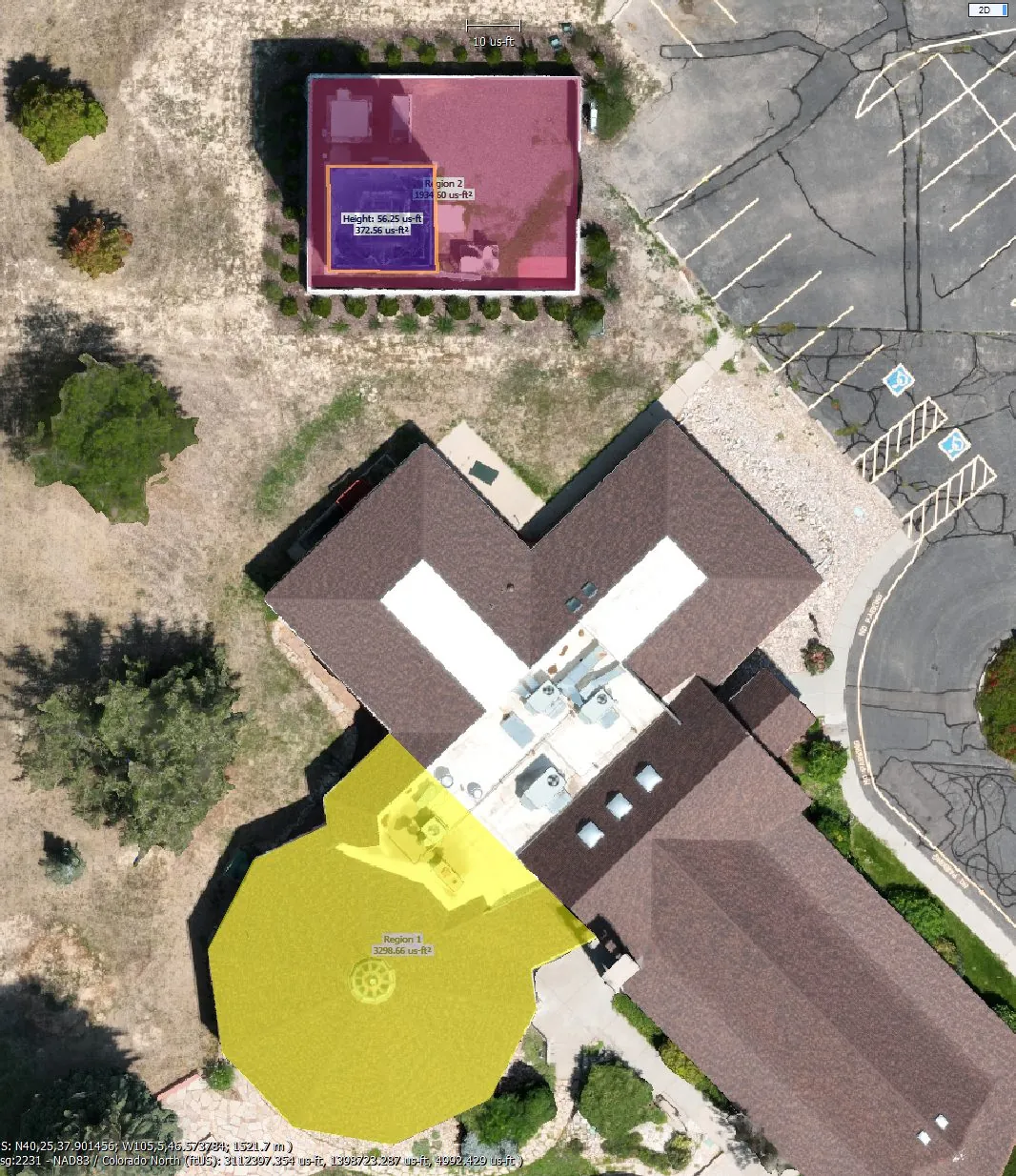
Overlapping aerial images are processed into a stitched, georeferenced top-down view. Use an orthomosaic to review visible site features and communicate the layout of a work area.
Point clouds & 3D models
A point cloud represents captured surfaces in three dimensions. A textured model adds photographic appearance, helping viewers explore structures and site context from different angles.
Aerial data collection
If your team handles processing, Angel Eye View can collect image datasets for your workflow. Define coverage, image requirements, and intended use before capture.
A shared view of site conditions.
An orthomosaic gives your team a common visual reference for discussing what is visible on the site. The portfolio example includes software-generated annotations; those annotations do not establish independently verified measurement accuracy.
Mapping products support documentation and visualization. Angel Eye View does not provide land surveying or establish property boundaries, and does not represent survey-grade or independently verified positional accuracy. Measurement-dependent uses require validation by the appropriate qualified professional.
From capture plan to delivery.
Describe the use
Share the site location, area to cover, features of interest, and how your team intends to use the data.
Set requirements
Agree on image coverage, processing responsibilities, reference system, and compatible file formats.
Capture and process
Plan the flight around the site and airspace. Processing is performed in-house, or source data is delivered for the agreed client workflow.
Deliver for review
Provide the agreed outputs and delivery information. Scope and turnaround are confirmed in the quote.
Make delivery compatible with your workflow.
Formats
Discuss GeoTIFF for imagery, LAS/LAZ for point clouds, OBJ for models, or PDF for presentation. The selected products and exports depend on the agreed scope.
Reference and units
Coordinate reference and units are agreed for each project and documented with delivery. A coordinate label alone does not establish accuracy.
Data handling
Angel Eye View processes data on encrypted local workstations. Third-party sharing requires written authorization.
Mapping or recurring progress photography?
Choose mapping when your team needs a processed top-down or 3D view. Choose recurring progress documentation when the main goal is a dated record of visible changes. A project can include both, with capture and processing scoped separately.
Explore construction progress documentation →Tell us what you need to see.
Based in Loveland and serving Northern Colorado, Angel Eye View can discuss your site, intended use, and preferred deliverables. Other Colorado projects are available by arrangement.
Request a mapping quote →Call 970-804-8035